Zion! It Was as Easy as A to Z

On May 18th I did 14.5 miles to Water Canyon. On May 19th I did 18.7 miles to the East Fork of the Virgin River. On May 20th I did 12.9 miles to Pine Creek in Zion NP. On May 21st I did 22.7 Miles to Lava Point in Zion NP. On May 22nd I did 21.9 miles to Lee Pass and finished the Hayduke.

Listen to “Vagabond” by Caamp. Often times the word vagabond is used in a slightly negative connotation, I personally think that people are just jealous of freedom.

After walking across the Arizona Strip, we hit highway 389 and did a 7-mile road walk into Colorado City, AZ. CO City has a pretty crazy past (you should google it) and 10 years ago hikers would not have been a welcome sight in town. The town today still has an odd feeling to it, but the people were friendly. We made our way to a brewery where we spent several hours hiding from the heat of the day and enjoying ourselves. We ended up hiking out 3 miles past town, loaded with a few road beers, a couple of pounds of candy, and blasting Latin dance hits... I think we were in a celebratory mood.

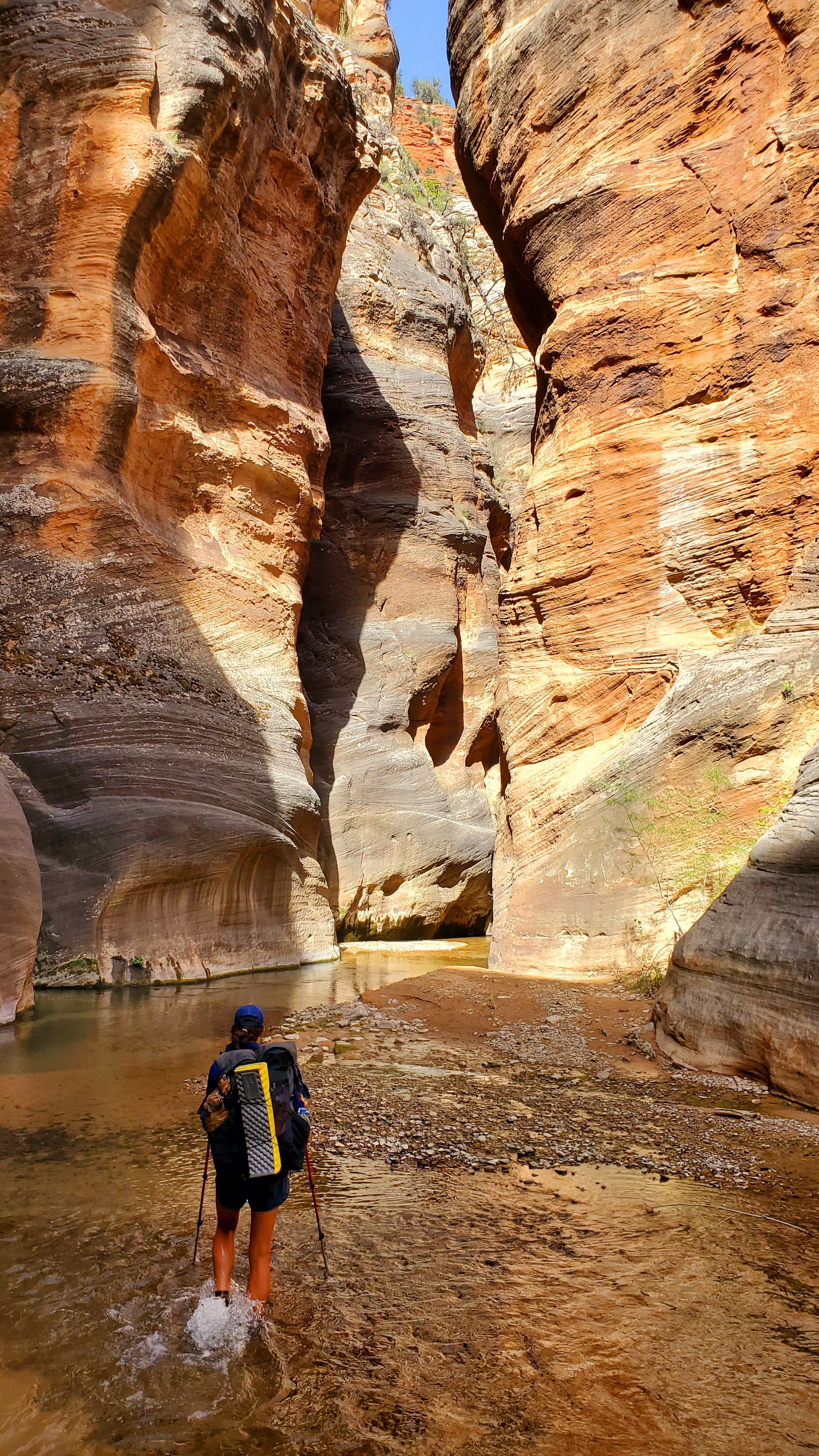
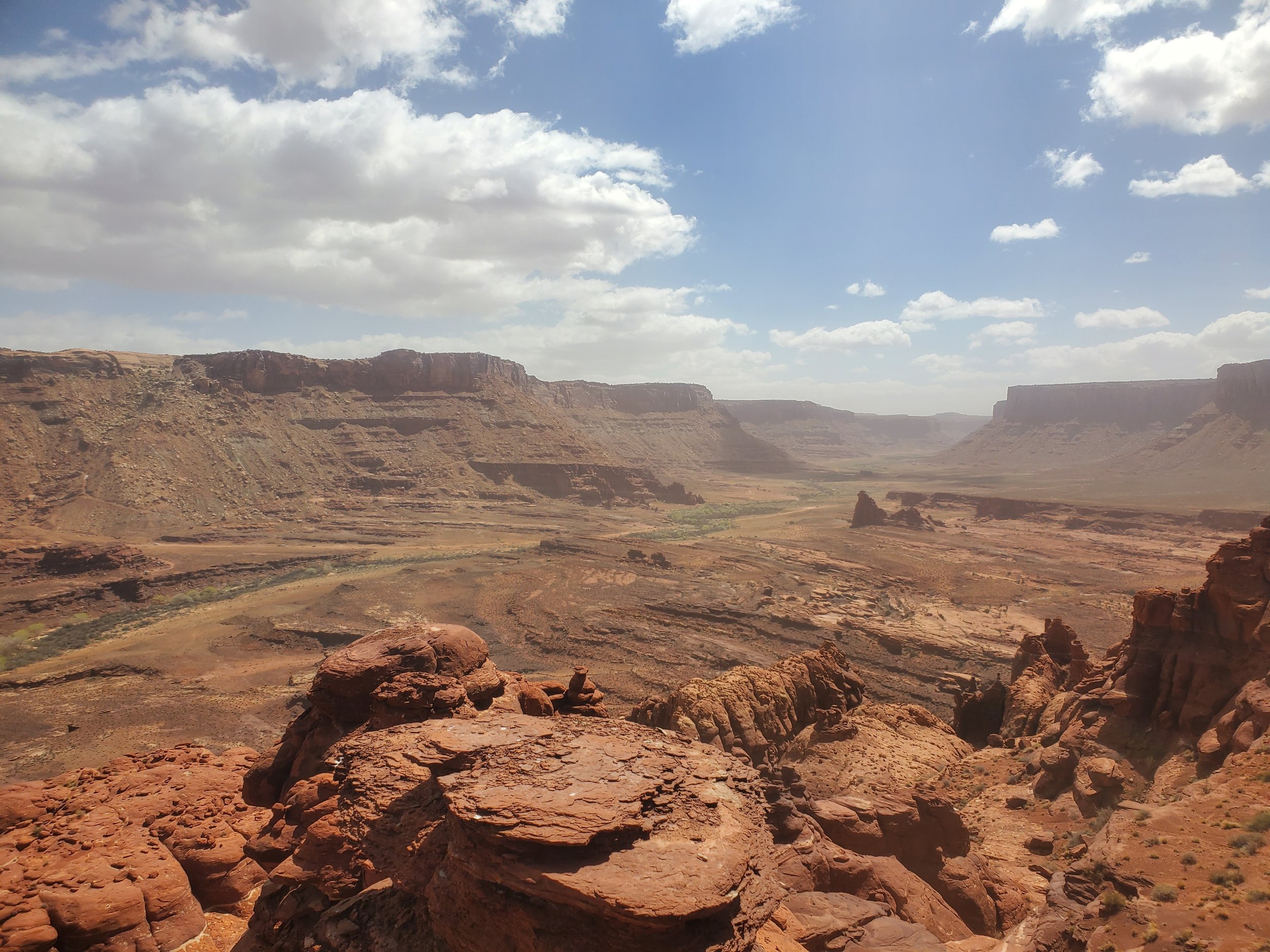
The next day was relatively chill as we made our way over a small mountain range and followed some double track to the Barracks. We caught glimpses of some amazing rock formations as we dropped into the canyon and meet up with the East Fork of the Virgin River. The river was flowing crystal clear, but there is serious concern about toxic cyanobacteria in a lot of the water in and around Zion. We ended up dropping our packs and walking upstream to collect water from a side canyon hoping to lessen the chances of getting the toxic bacteria. As we made our way through the riparian zone we came across two large rock walls full of petroglyphs, one with a giant bear paw that I really liked.

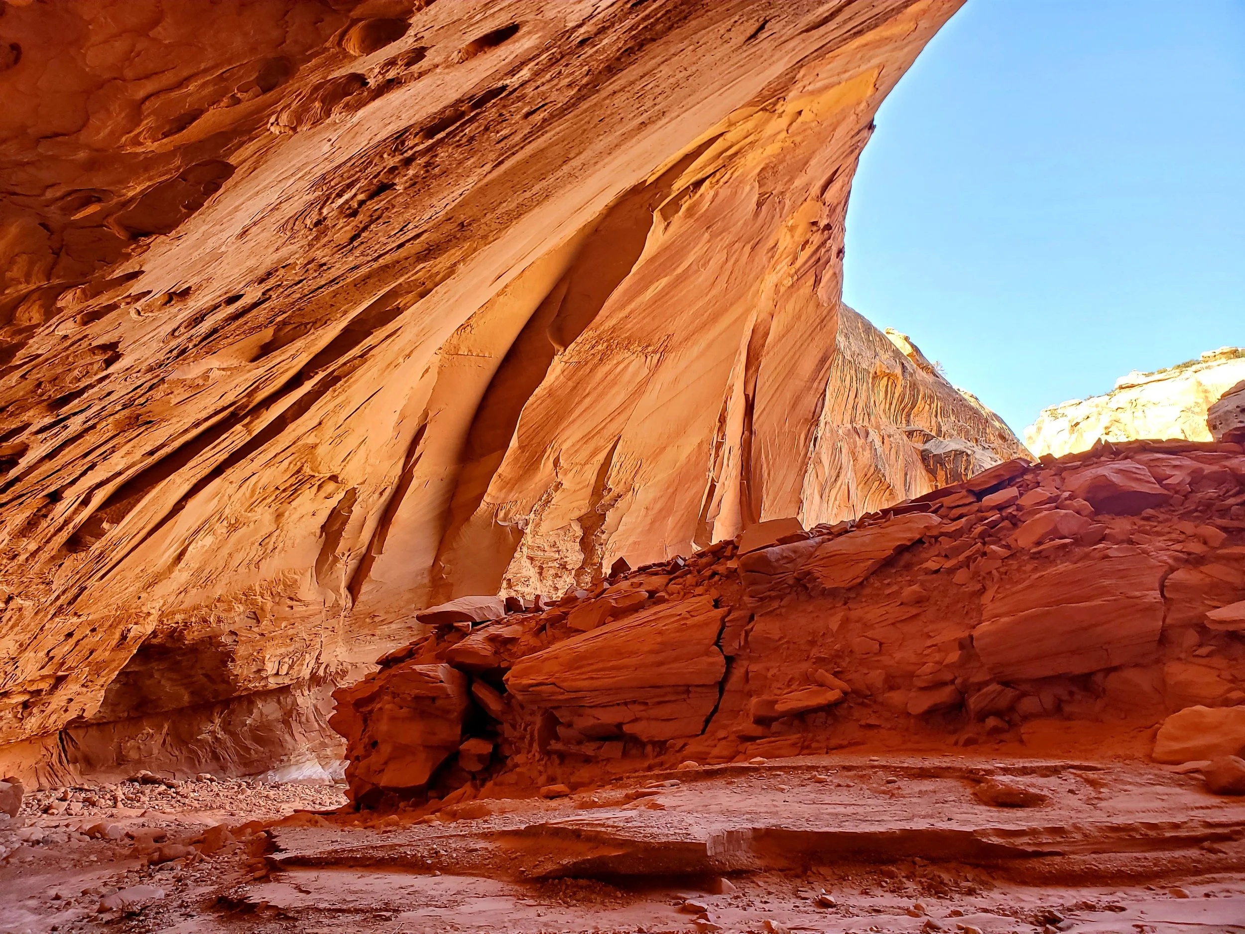
The next day was a super fun day in the Barracks. The Barracks is a nickname given to Parunuweap Canyon (Parunuweap was also the original name of the National Monument before it became a National Park and was renamed Zion). The canyon was about 4 miles long and the water could get well over 6 or 7 feet deep but we were able to navigate down the river on sandbars and ledges. It took us 6 hours to do the 4 miles and we were having so much fun. At times the canyons got narrow and were reminiscent of Buckskin Gulch but with fast-moving water. It would be our last water adventure of the trip so we really soaked it in (pun intended). We climbed up a wall out of the Barracks and started to make our way north on sandy trail and slickrock. We eventually broke into Zion, the 6th and final National Park, and around 4 pm we hit HWY 9 which is the unofficial end of the Hayduke. The official end to the unofficial trail is Weeping Rocks in Zion but because of two huge landslides in 2018 Weeping Rock has been closed and without a new Terminus, many Haydukers call it at HWY 9. Sprinkler and I took a celebratory photo, and yogied a beer from a tourist but ending at a highway didn't seem like a great finish. So it was decided we would make Lee Pass in the Northwest Corner of the park our end point.

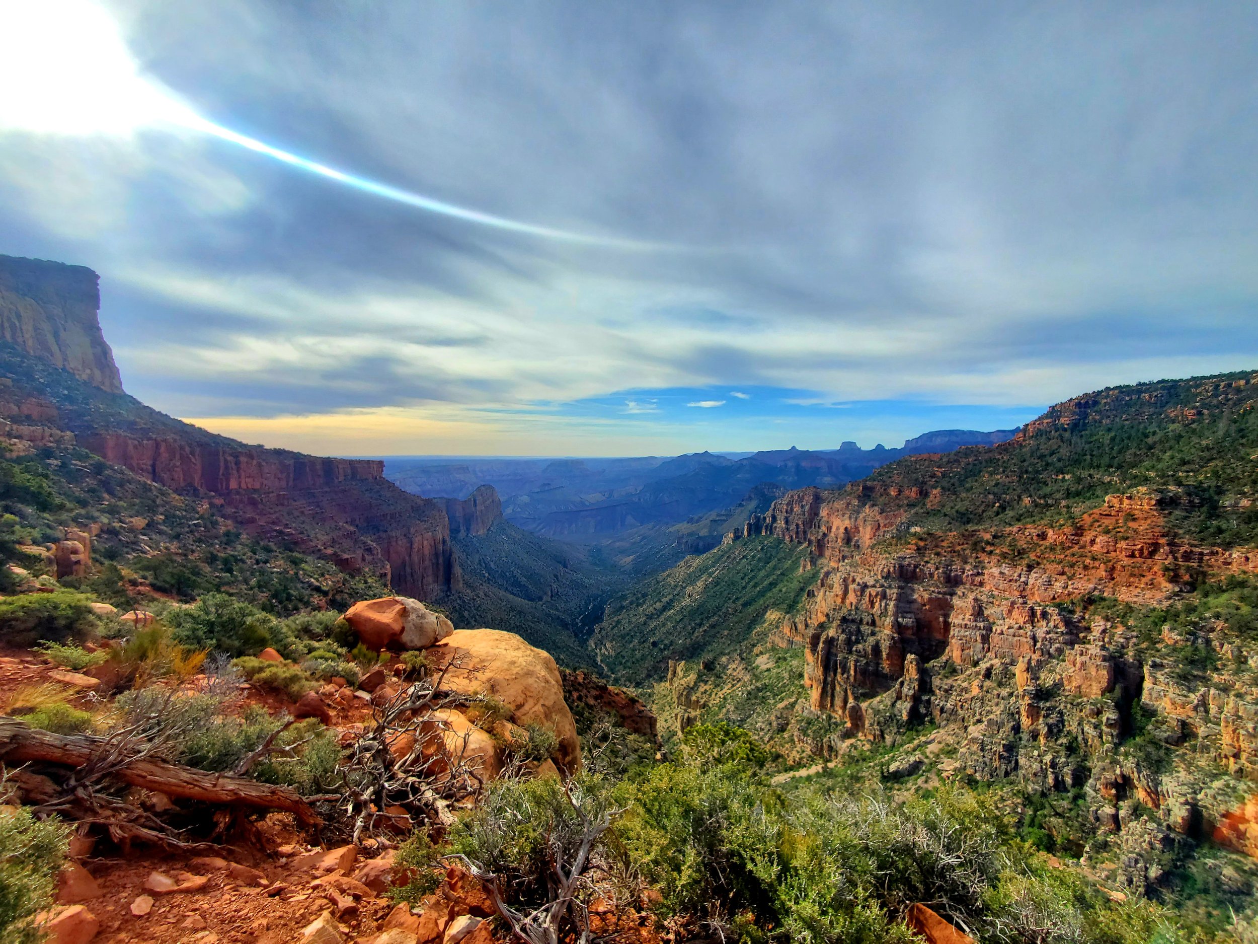
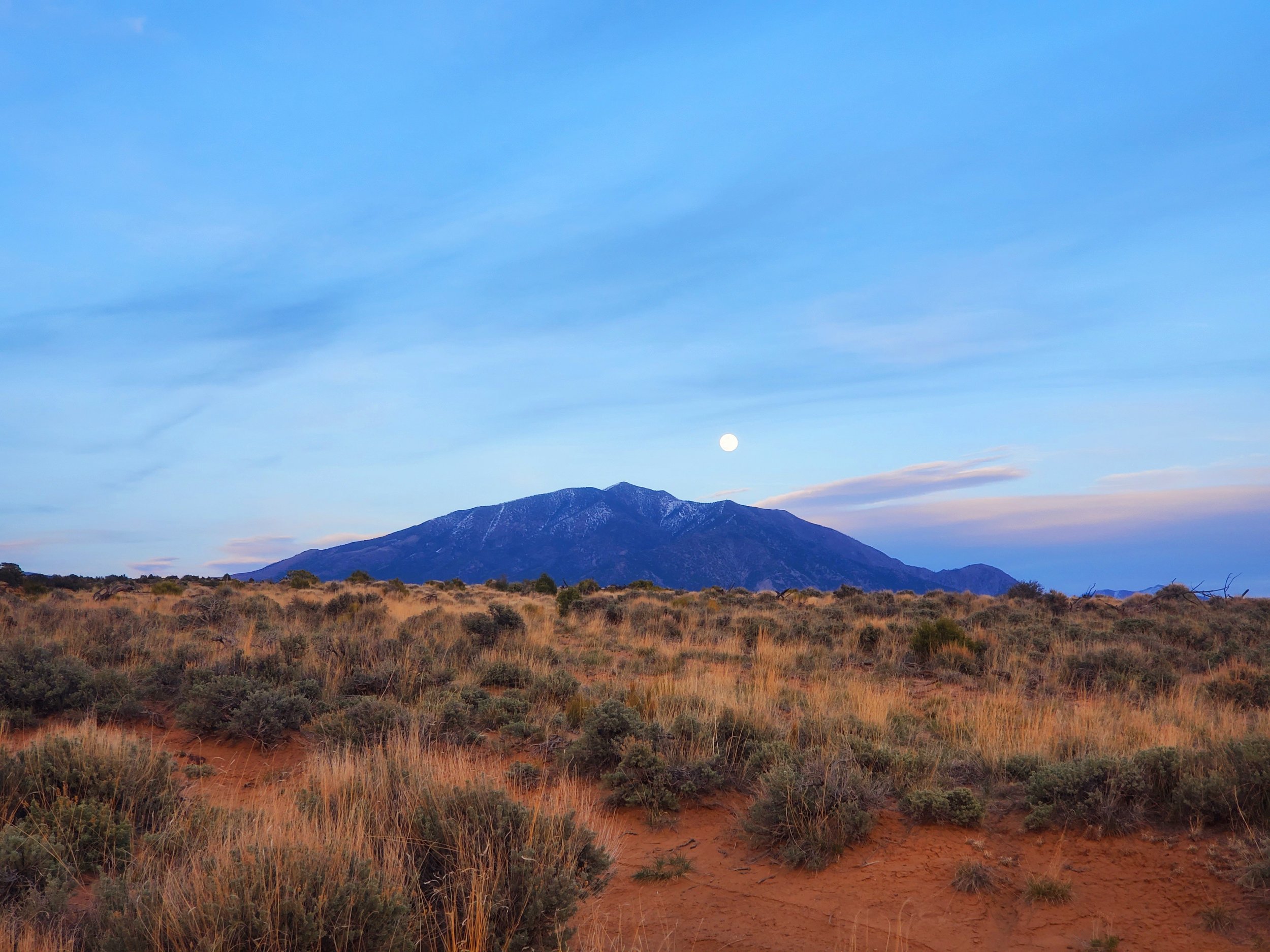
It was a 12-mile road walk on HWY 9 to get to the West Rim/Bright Angel Trail Head. We had to walk through two tunnels to get there the first tunnel was 900 feet long and we just ran for it hoping not to meet a car in the middle of the tunnel. The other tunnel was 1.1 miles long so we stealth camped near its entrance and got up super early so we could walk through it without having to play chicken with a car. We eventually made it into the heart of the park and were surrounded by smelly tourists (you can actually smell people's laundry detergent after being out for a month). After passing by the turn-off for Bright Angel the trail almost cleared out completely and we had absolutely stunning views of Zion from its West Rim. Zion was relatively chill. The hiking was easy and at times we had grand views of the rock formations and at times we were hiking in forests of scrub oak. It was a bigger day getting into the backcountry which had us stealth camping at Lava Point (permits are the arch-nemesis of thru-hikers). From Lava Point, we had 22 miles to Lee Pass. Initially, we planned to break it up into 2 short days since we didn't want to have a huge day in the end and have a late finish but since the terrain turned out to be easy we went for it. We got up at 4 am to a very cold last morning on the trail (my coffee froze) and headed out via headlamp. It's always a weird feeling ending a trail. I got us turned around by going down the wrong canyon (we decided to just go for it and follow the canyon instead of the trail which lead to some interesting downclimbs). We were definitely moving with the intention of hoping to finish before dark so it would be easy to hitch out of the park. I guess we were really pushing it because by 330p we had done 21.9 miles and reached Lee Pass finishing the Hayduke. The Hayduke surpassed all expectations it was definitely an emotional finish.

……

Did I seek out one of the hardest adventures I could find just to see what would happen... yes. Did I think at times I would quit... yes. Did at times think I was actually going to die out here... yes. Would I do this hike again... hell yes!

It was a crazy journey, and I left out some of the extreme stuff because my mom reads this blog and I don't want her to worry any more than she already does but there were some other moments on the trail that left me speechless and happy that I got to watch the sun come up the next day.

As always it was a spiritual journey too, with a lot of self work done in the canyons and a lot of lessons learned. A lot of what I learned is more of a feeling of peace and not easy to put into words but there were two overarching motifs to my experience.

We all die, none of us make it out alive. We worry about losing things and cling to what we do have, but in the end, we are going to eventually lose it all anyways. So why not take chances? Go for it and see what happens, you really have nothing to lose, because it's all temporary anyway.

Life isn't about perfection, it’s about learning, growing, and doing, and should be a little messy. Focusing on the past just steals from the present and doing what you want. Don't look back on the past for any reason other than to bring lessons learned forward and don't worry about “what ifs” and longing for a "redo", you got a redo when you woke up again this morning.

The Haydukers Have Gone Feral

On May 11th I did 21.2 Miles to the North Rim Campground. On May 12th I did 21.1 Miles to Swamp Point. On May 13th I did 13.1 Miles to Saddle Canyon just Pass Jug Canyon. On May 14th I did 11.7 Miles to Fish Canyon. On May 15th I did 12.9 Miles to Showerbath Spring. On May 16th I didn 22.3 Miles to Hack Canyon. On May 17th I 27.7 Miles to Maroney Well.

Listen to "Koto" by CloZee. This song is guaranteed to make you move 10% faster, which was needed on this intense section. Try it and see if you don't actually move faster, if I'm wrong you can buy me a beer.

After resupplying in the S.Rim I found a campsite in Mather Camground and tried to get some shut eye before doing Rim to Rim the next day. I initially didnt plan on going up to the S.Rim for a resupply but since the N.Rim doesn't open till the 15th of May I had to change plans. The Rim to Rim hike isn't terrible, it ended up being a 21.2 mile day with 4,600 feet loss and 5,800 feet gained. It was straightforward going down and across the Colorado river again but instread of hitching across I took the more pedestrian way and used the suspension bridge. I took a late lunch at Ribbon Falls which felt like an oasis in the desert canyon, it was a much needed reprive from the desert heat. The winds were horrendous all day and actually knocked me over, it didnt help that my pack was super heavy with 8 days of food and at the base of the climb I had to collect and carry 8 liters of water since the next reliable source was 38 miles away. It was a little slow going but the North Rim is soooo beautiful that taking extra time to go up it wasn't a burden. The North Rim trail is drastically different than the South Rim and had us winding around the red rock Canyon walls for miles as we worked our way up to the plateau.

On the way up Sprinkler and I met a Ranger. She turned out to be a PSAR (Preventative Search and Rescue) Ranger. This is a unique job tittle that started out in the Grand Canyon. In 1996 there were so many deaths and accidents in the Grand Canyon the Superintendent almost closed the entire park to give the first responders a rest. So in 1997 they created PSAR and their job is to help distraught people in the park before it becomes and emergency. We hiked with the Ranger for the last 2 miles of the North rim trail and had so many questions about desert emergencies (I definitely did not tell her I had heat exhaustion a few days ago). We parted ways at the top of the rim (I now have a new list of books the ranger suggested I read) and made our way to the N. Rim Campground. The next day was a chill walk along some double track which allowed us to sleep in as the temperature at night was in the 20s. The double track lead us to North Bass Trail head setting us up for the hardest section of the trail.

The guidebook lists the next section as extreme (the only section listed this way), which is probably a good description of the route; it was both extremely hard and extremely beautiful and worth all of the blood and sweat (the tears were saved for joy). After North Bass we bushwhacked through a canyon for 4 miles, navigating dryfalls that required us to lower our backs via rope, and going cross country on unmakred and loose terrain with serious fall consequences. We were going less than 1 mile per hour trying to make our way into the heart of Saddle Canyon. We were able to reach the section of the canyon where the walls got super high and close together creating a narrow path filled with polished sandstone and plunge pools. We probably went through 20 pools, some only thigh deep and some up to the waist. Entering the pool was the hardest part as there was no easy way to lower yourself in, you usually just had to slide in and hope for the best (on one I slipped and ended up landing on my back in the pool). Other times we would hand each others packs down and ferry them across above our heads. It was such a fun canyon and it allowed us to cool off, plus the water in the canyon gave way to some unique flora and at times it felt like we were walking through a conservatory. The next day started with some slow boulder hopping where we meet up with Tapeats River. Tapeats river is a river feed by a spring that just comes out the side of the mountain and is absolutely raging and has white water in it. I had never seen a single spring fed river before have so much power (I only took pictures at the safe spots and needed to be ready on the dangerous crossings so the pictures I do have look chill). We followed the river down the canyon for 1.3 miles which took us 2 hours. We had to cross the river many times navigating the rapids and at times just had to walk down the middle of it because of the sheer canyon walls. The river had swiftest water I have ever crossed and the irony of crossing a super strong river in the middle of the desert was not lost. We left Tapeats River and made our way up Thunder Spings which was another huge water source that is literally being pressed out the side of the mountain. After topping out we went through Suprise Valley and down Deer Creek to a stunning narrow canyon with gushing water. The canyons water was too swift and had too much white water to ford, so we had to walk the top of the rim and followed it until it dumped into the Colorado River. This was our third time hitting the CO River in the Grand Canyon. We followed the river down stream for 7.5 miles following game trails as we made made out way over talus slopes, benches and the occasional sand bar. The going was slow and hot (the temperature reached 98 degrees), but the surroundings made the slog worth it. We camped at Fish Canyon and got up at 430am to start the.next boulder hop. It was an extremely tedious 4.5 mile long boulder field along the Colorado River. I got to Kanab Creek at about 930 and waited in the shade for Sprinkler, she didn't come up to the creek till 1030, I was wondering if something went wrong but it was just the opposite. Some rafters saw her scrambling on the rocks and yelled out to see if she wanted a care package. When she said yes they were able to leave some fruit and cider in the river that she was able to scramble down to and get (this is the the 4th time we have gotten beer/cider from rafters!). We decided to take Kanab Creek slow, partially because it was super slow going around the boulders and partially because it was the coolest canyon we had been in. There were swimming holes around every bend that we could dive into. We were going about 1 MPH but that was mostly because we were busy eating our rafter care package and swimming the entire way up the canyon. We made a small side trip up to Whispering Falls which was one of the most peaceful places I have ever been with a crystal clear pools underneath. We then set out sights on camp and made a push before dark. Camp was at Showerbath Springs. There was a cluster of ferns about 15 feet in the air, 30 feet long and 20 feet deep that water was just pouring out of. I took a cold shower underneath the ferns and jumped into the pool behind it for a bath (I now get why it's called showerbath) and repeated the process a few times and felt euphoric before crawling into my sleeping bag.

The next day we continued to follow Kanab Creek Upstream, about 2 Miles from camp the water disappeared and we were walking on a dry creek bed. We followed the dry bed to Hack Canyon, which was also dry making it a 25 mile water carry to Hack Resevoir. Sprinkler had a cache at Hack Reservoir, she initially was hiking with another partner so there is extra snacks and water in her cache I could use, which will help me get to Colorado City without completley running out of food. I am super thankful for the extra little bit of food, as I have been extremely calorie deficient and was having a hard time rationing food as I am down 27 lbs (my belt had a 2 inch tail on it when in started and now it's over 8 inches). After getting extra food at the cache we made our way towards Colorado City going across flat(ish) sage brush country.

Both Sprinkler and I are pretty tired, when ever something shitty things happens we don't even get mad we usually just laugh about it. After packing up one morning Sprinkler brushed up against a cactus and her leg looked like a porcupine, she didn't even notice at first and just nonchalantly pulled all of the needles out. When I fell into the plunge pool my dinner got wet with stagnant water, the options were simple, eat it as is or don't eat anything, I definitely ate the dinner. We joke that we are going feral and I sometimes wonder if it's actually a joke.

Canyon County

On May 4th I did 22.1 Miles to Crane Lake. On May 5th I did 24.9 Miles to Nankoweap Trail Head. On May 6th 15.6 I did miles to Kwagunt Rapids. On May 7th I did 14.4 miles to Tanner Rapid. On May 8th I did 19.0 miles to Horseshoe Mesa. On May 9th I did 18.2 miles to cremation creek (who names these places?). On May 10th I did 6.5 miles to the South Rim to resupply.

Check out "Hold On" by Alabama Shakes. I'm doing my best to not get blown off any cliffs; everytime a strong gusts comes I just have to stop hiking and hold on so I don't go for a 300 foot dive into the Colorado River.

I made it to Jacob's Lake, resupplied and rested. There isnt much going on in Jacob's lake, It's pretty much a tourist stop if you are going to the North Rim, so I chilled in my room sipping on a beer and looking over maps and water options. In the morning I grabbed breakfast at the diner and I saw a few AZT hikers but one of the hikers looked different, she looked like she had seen some shit and then I noticed she pulled out a Hayduke map. Holy crap another Hayduker! Her name is Sprinkler and we actually hiked around each other on the PCT in 2016 and she was at the Canadian Border the day I finished. She had been doing a bunch of alternates on the Hayduke that allowed me to catch her; I was super excited there was another Hayduker who was going to be on trail around me!

I jumped back on the AZT after eating 2 large breakfasts and an extra stack of pancakes (I think I need to up my calories). The AZT is pretty chill compared to what I had been on and the terrain and flora reminded me of Tahoe even though the Kaibab Plateau and North Rim were only 15 miles away as the crow flies. With the easy terrain I knocked out 20 miles after only a half day of hiking. Sprinkler caught up with me that night and we camped together (she is redicioualy fast), it was one of the coldest nights on trail as we were around 8,500 feet. It was a quick morning to build up body heat and before I knew it we were 25 miles down trail at the Nankoweap Trail Head with my first real view of the Grand Canyon!

Holy Shit, I cannot believe I finally made it to this point. I started off this trail terrified of the undertaking thinking I was possibly going to quit, then I got a little comfortable and figured I had a chance to finish it if I pushed hard enough, later on I figured I had the skillset to see this through, and now I'm looking down into the Grand Canyon wishing I had a beer before I jumped in. The Nankoweap Trail is one of the hardest trails in the Grand Canyon according to the National Park Service, it drops you down from the rim into the canyon over 14 miles. It's steep and loose trail with epic views the entire way down. The Nankoweap Trail and actually all of the "trails" we were on had several 100 feet drop offs just a few feet off trail, this made time stand still when strong gusts would start blowing as you braced yourself and in all seriousness tried to not get knocked over. I must have hit the perfect season to enter the canyon because as I made my decent I was surrounded by gardens of blooming cactus. Everywhere I looked were unique cactus sprawling out on the desert walls and floor, their flowers covered the entire color spectrum. It was a long steep decent but there was an amazing spring at the bottom which had cold clear water in it! I followed the spring to the Colorado River and made my up to a small side quest to check out the old Anasazi Graneries which were nestled high into the cliff walls. I ate lunch at the Graneries and reflected on how an Ohio Boy who barely passed third grade now picks up and drops good engineering jobs as he wishes and is able to hike across some of the most amazing place in the country (life is not a straight line). I wanted to go another 8 miles down river after the Granaries to setup for an easy river crossing the next morning. I made it about 3 miles before I started to puke. Damnit... I knew I was pushing myself to hard... heat exhaustion. I basically crawled the next 0.6 miles till I had river access and dunked my body in the cold Colorado River. It wasn't a lack of water, it was a salt imbalance, I had drank over 12 liters of water that day and hiked through the hottest parts of the day without proper rest or nutrition, I knew better but pushed myself always. I was able to get more water and set up camp at 530pm and rest. You gain or lose 3 degrees Fahrenheit per 1,000 feet of elevation, so by going down 6,000 feet it became 18 degrees hotter without factoring in any weather changes. When I was able to get an actual weather report for that day I found out it was 99 degrees in the canyon; from here on out I'm going to have to get an earlier start and take a long 2 or 3 hour break in the middle of the day.

Sprinkler caught up with me that evening as I recovered and we made an early go the next morning (luckily she had salt tablets to give me). We had to get 6 miles down river where it would be easier for a passing raft to stop, pick us up and take us across the CO. There was no trail and it was a long 6 miles along the bank but we finally made it to the beach by 9am. We were super lucky and a raft passed us 20 minutes later. We flagged it down, it beached and we jumped on. The whole process took less than 3 minutes. The rafts took us 0.5 miles down the river and stopped at the Little Colorado. The Little CO is famous for having turquoise water. After getting off boat, snagging a few beers off the rafters and crossing the Little Colorado we joined the Beamer trail and continued on the Hayduke.

From the Beamer trail we spent the next 3.5 days on a network of trails that generally went down the Canyon. We held on for dear life when the strong winds would come throughout the day and rested during the high sun. At times we were hiking along the sandbars and at times we were 2,000 feet above the Colorado looking down into the canyon. Everywhere we looked were awe inspiring views. On the last day we took a detour with 3,600 feet of elevation gain to the South Rim for a resupply. The South Rim is not on trail but since the North Rim does ’t open until May 15th we had to make the additional stop to grab more food for the next section of the Grand Canyon.

Hardboiled Eggs and Beer

On April 28th I did 16.1 miles to Pasture Wash in Bryce Canyon NP. On April 29th I did 20.0 miles to Podunk Trailhead. On April 30th I did 22.9 Miles to a road near Kitchen Coral Wash. On May 1st I did 24.2 miles to the beginning of Buckskin Paria Slot (after going in and coming back out). On May 2nd I did 23.6 miles and camped near the Najvajo Trail Trick Tank. On May 3rd I did 13.5 miles to Jacob's Lake.

Listen to CCR "Up Around the Bend". This has been an absolutely amazing section and I have been so suprised and excited with the trail. I can feel my energy levels dropping a little but the excitement I'm getting from the trail is keeping me going on all cylinders and I never know what’s going to happen around the next bend.

I left Willis Creek narrows and popped up onto a jeep track. I decided to take an alternate that had me follow the double track to HWY 12 which leads to Tropic, UT. It's a 15 mile walk along the dirt road and eventual pavement that set me up for an easy resupply and a grand entrance into Bryce Canyon National Park. The actual Hayduke cuts directly west from Willis Creek and enters Bryce in its southern section for only 10 miles, this alternate will give me 35 miles inside the park. I did my town chores and had three huge meals while reflecting on hitting the halfway point on this trail. I shouldn't be this hungry after only 450 miles in, but my body and mind feels like I have hiked 1000s of miles already. Not only is my body a little worn, my gear is also in really rough shape, I've never destroyed gear this quickly and will be suprised if there is any life left in it after this adventure.

The main reason I took the alternate was for an easy resupply and had no expectations of what Bryce Canyon was going to hold and figured a few extra miles on a national park trail wouldn't hurt anything. Maybe the key to life is to keep expectations low because I was utterly shocked when I entered the park. I hiked up from the valley floor and made my way up to the rim. I was hiking slow, partially because of the epic views and partially because my body wasn't happy about the entire XL pizza I ate the night before. The morning was overcast but still had a little light coming through making the juxtaposition between a gray sky and brightly colored orange walls even more surreal. I meandered my way up to sunrise point where I was greeted by hoards of tourists. I was a little concerned because they were all out of breath, I wasn't sure if there was a new covid variant or if they were winded from walking the quarter mile from their cars. I took so many pictures and probably only hiked 1 MPH around the top rim just looking down into the valley below trying to comprehend all of the unique formations. I should probably do more research on the areas I'm going to hike, but this suprise had me smiling ear to ear. I followed the trail around the rim and dropped down to another trail appropriately named "under the rim" trail. I followed this trail for about 26 miles around the rest of Bryce. I didn't realize I had gained so much elevation and left the sage brush behind. I was at about 8,000 feet and it felt like I was back in the Sierras with manzanita, douglas fir, and ponderosa pine, except the Sierra granite was replaced with Bryce Canyon sandstone. I had enough food in my bag to go slow and enjoy the park so I did, taking lots of breaks and enjoying every vista. I got up to 9,000 feet and had a stunning view looking back at where I came from and a good look at the Kaibab Plateau which is where I was going. I followed the trail to the park boundary and entered Dixie National Forest leaving the giant orange walls behind.

The next day was super cold and I definitely stayed in my sleeping bag until the sun thawed me out. I got up and did a quick 4 miles down a jeep track till I hit a wash and entered it before I took my morning coffee break. While I was making my cold brew (if you shake it vigorously it gets a foam layer on it and if you close your eyes you swear it's a cappuccino (if you believe that I've got land to sell you)), I looked up and saw a Hayduke Hiker named MacGyver. I briefly met him outside of Hanksville two weeks ago and he has been following my footsteps ever since vowing to catch me (he was hiking with a slow group or he would have caught me almost immediately). I was excited to see another Hayduker on Trail as I haven't seen anyone since Ben at Neeedles Outpost. MacGyver sat down in the wash and ate his second breakfast with me. It turns out we camped 200 yards from eachother the night before but didn't see one another. MacGyver was on a mission to make miles since it was actually his last day on trail, and we decided to hike together for a bit. He decided that after the half way point of the trail he would come back and do the other half another time. He was aiming for a road 25 miles ahead of us where his partner was going to pick him up. I was excited to hike with him, but he moves well over 3 mph, probably closer to 4 mph so I was basically jogging to keep up. The canyons kind of sucked, they had super loose and fine sand that I dubbed Sahara sand since you just slide around in it and waste a ton of energy trying to hike through it. It was probably an 8 mile section of bad sand and to be honest maybe the worst 8 miles of trail so far but with the great companionship and conversation it made it bearable (the one highlight was an amazing sundog we saw over a mesa). It was a bummer this was MacGyver's last day on trail, we actually had a ton in common and talked everything from politics, to diesel engines. We eventually made it back onto hard pack trail and started to pickup speed when I heard a rattle and about plowed MacGyver down as I jumped out of the way. It was a decent size rattle snake hanging out under some sage brush. To be fair I'm not afraid of snakes, I just have a serious phobia of small children and figured there was a baby with a rattle in its hand playing in the sage brush, I definitely wouldn't jump out of my skin because of a snake.

We were making good time and hit the road. His partner Salt, came driving down the road about 20 minutes after we stopped for a break. She had loaded up on veggies, beer and hardboiled eggs and set out a platter on the back of the car. I was extremely happy for the random trail magic and we ended up hanging out on the side of the road for almost 3 hours. They had hiked the PCT in 2020 so we had plenty of hilarious stories to swap. It eventually got dark and we had to call it a night. We exchanged info and with any luck we might actually all be doing a rafting trip outside of Boise in early June (MacGyver is a raft guide). I made my way to tree line to hide from the wind. It's probably best that I slept alone after only having a beer and an egg for dinner, but it was nice having an extra warm sleeping bag.

The next day I had one thing on my mind, the Buckskin Paria Canyon. The Buckskin Paria Canyon has 19 mile slot canyon in it which is the longest in North America! I had a decision to make, which was to take an alternate and hike the entire Canyon (which would be a total of 100 mile alternate once you hike the slot and canyon and reconnect to the Hayduke) or to skip the alternate and stick to the original route. This caused me a lot more mental stress than I want to admit. Any given day leading up to this I could be 100% sure I was doing it and then the next day be 100% sure I wasn't going to do it. The Hayduke has taught me a lot and one of those things is finding the right balance between pushing yourself and letting go of shit that isn't going to make you happy. I decided the full blown alternate was a little much and I should add it to the long list of places I need to come back to. I ended up still going into the slot canyon for 4 or 5 miles (hard to tell since GPS doesn't work in them) and then turned around and came back out so I still got to experience 8 to 10 miles of going through a fun slot canyon. It was such an impressive section, I took over 100 pictures but as always they never do any justice. It was a really cool side trip and a good compromise.

I woke up the next morning and went through a small slot as the sun was peaking behind the rock formations. There is a really cool feature called the "Wave" about 2.5 miles off trail which draws people from around the world to see. Unfortunately it has a strict permit system and a heavy fine for going in without a permit. Through a lot of sheer luck I ended up meeting a woman who had an extra spot on her permit and I was able to go in. Her name was Alisha and who was on a 2 week road trip, and hiked so fast I could barely keep up. It was so much fun to have a companion going cross country to the Wave. We spent the better part of 4 hours exploring the wave and the surrounding areas and doing photo shoots. The photos turned out pretty good but still don't capture how cool the area was. We walked back to the trail head together and she was going to go explore some of Buckskin Gulch, I did my best to try and convince her to jump on the Hayduke but she had a new residency to start (finishing your MD is probably smarter than hiking the Hayduke, but not nearly as fun).

After leaving the WAVE I entered Arizona and joined the Arizona Trail which I'll be on for the next 64 miles (yes someday I will hike the entire Arizona Trail, I just couldn't figure out how to fit it in this year) It's exciting to enter AZ as I have never hiked in this state. The trail is pretty beat in making navigation super easy, plus there is tree coverage; I definitely appreciate the change in the trail conditions and feel kind of spoiled. This section was full of surprises and amazing people which have significantly boosted my spirits.

Utah Slots Are a Gamble

Listen to "Wild Grin" by Rural Alberta Advantage. I wake up every morning and pop my head out of my sleeping bag in the canyonlands with a big grin knowing this is the dumbest thing I've ever done and its no secret I love it.

On April 20th I was dropped back off and did 2.5 miles near Willow Tank Slide. On April 21st I did 16 miles after fighting Monday Canyon to Roger's Canyon. On April 22nd I did 20.4 miles to Reese Canyon and camped next to Last Chance Creek. On April 23rd I did 21.8 miles to Kaibito Spring in Paradise Canyon. On April 24th I did 21.7 miles to Round Valley Slot Canyon. On April 25th I did 23.6 miles and camped along the Paria River. On April 26th I did 22.5 miles to Willis Creek. On April 27th I did a 15.1 mile road walk into Tropic.

I am so thankful for the ability to recharge in Escalante. After the last section I was pretty beat up mentally and physically and needed a day off trail and there is no one better way to do it than to spend time with another thru hiker who understands exactly what I need (his exact words were "you look frazzled"). Escalante is a small town but it does have a bakery and I pretty much spent the entire day on their patio just going in for more rounds of baked goods and hot coffee. I did have one beer when I came off trail but to be honest I've had almost no desire to drink on the Hayduke, I dont know if it's because I'm borderline always dehydrated or what, but normally on a trail grabbing a beer was the first thing I would do in town and now it's not even on my to do list (I must be getting old).

Z dropped me back off where he picked me up and I started the next section. Infront of me was a wall that is 50 miles long (it's called the fiftymile bench) and 1,300 feet high. I just stared at it because it wasn't obvious how I was going to get to the top. I followed the map which lead to a horse trail which lead to a section of the wall that someone carved a trail into, it was steep but doable and at the top I once again got stunning views of the Escalante river basin (it looks better from a far rather than from down in the hellish river banks).

I cross-countried across the mesa to a clear running spring and tanked up on 8 liters of water before heading out to Monday Canyon. There was a remote cabin near the spring which is literally in the middle of nowhere. I've seen way to many horror movies and don't even snoop around them and just keep moving before anybody or anything realizes I'm there. The next canyon I entered was Monday Canyon, and it was rough going. It had boulders strewn about it the entire length of the canyon, some the size of cars and some larger than houses. It reminded me of Mahoosucs Notch on the Appalachian Trail, but was 10 miles long vs 1 mile on the AT. You have 4 options when going around the obstacles:left, right, up and down (yes down is a option since often you can often crawl through the crevices) I always pick the wrong way and end up back tracking to get around the huge blockades. At the end of the day I was beat and only managed a 16 mile day. I set up camp in Rogers Canyon next to some running water (which wasn't supposed to be there, but ill never complain about additonal water sources) and passed out by 830.

The next day I continued to boulder hop through Roger's Canyon until I hit Navajo Canyon, the floor of Najavo Canyon cleared up and had a lot less obstacles. I got my hiking groove back but I guess I was so excited that I was able to move freely again that I missed my canyon turnoff and went a mile down the wrong canyon (I hate when I do that). The skies were looking ominous and it started to rain really hard, I wasn't thrilled to be in a canyon at that moment because of flash floods and kept my eye out for all of my possible escape routes. I am told you can hear the chocholate milk of death coming about 10 to 15 seconds before it hits so I didn't have any music or audio books playing; I hope to never find out if that warning is true or not. Rule #2 in the desert is water dictates all logistics. This may sound obvious since the lack of water is typically most peoples fear in the desert and water sources dictate the hiking route, the seasons you hike, the speed at which you can hike and the amount of reserves you carry between points; but too much water also dictates your movement. Flash floods kill people every year and since the drainage of some of the tributaries are so large you can get caught in a flash flood and have blue skies above you because it's pouring rain upstream and you never even saw a rain cloud. I always keep an extra days of food on me incase I have to abandon a canyon and wait out a flood above the water line. I'm hiking before the wet season so my chances of getting caught in a flood are small, but there have been some crazy weather patterns the last few years so I don't take anything for granted.

I jumped on a jeep road for 18 miles and it dumped me out at Grosvenor Arch. This may sound pretentious but arches right now are kind of like cathedrals in Europe, after you have seen 20 of them they kind of lose their luster, but Grosvenor was different it's kind of like the Dom in Köln (Cologne to you heathens). It was a triple buttressed arch with a lot of interesting features and I have never seen an arch like this before. You can actually drive to it, but that didn't even take away from its mystic. After visiting the arch I made my way down trail another 4 miles to get me last buried cache. I started to dig and hit a white bucket pretty quickly and after moving all of the dirt around it I realized I did not recognize the lid. I was really confused and after proding the ground I hit another bucket and after uncovering it realized the second bucket was mine. This was super bizarre. There are no marked spots for caching food, in fact the more obscure of a spot the better. I buried my food about 100 yards off a dirt road in a relatively undescript area, the only way I mentally marked the location was it was next to a dead tree. I didn't move or open the first bucket, I just covered it back up so I don't know if there was food in it or if it had already been used. Now I'm going to spend the rest of the hike wondering who buried their food first, did I bury it next to someone else or did they bury it next to me. I'm still trying to calculate the odds of two of the few Hayduke Hikers placing a cache within a foot of each other when the the option to bury is 100's of football fields in area.

After organizing my resupplies I headed down Round Valley Canyon. There was a slot canyon infront of me, but since I didn't know exactly how long it was I decided not to enter in the evening and get an early start in the morning. My alarm went off at 530a the next morning and I reached for my water bottle which was a solid brick of ice (that might explain the poor sleep that night). There was no way I was getting up in the dark in sub freezing temps without my down jacket which I conveniently mailed home in Escalante. The weather report said it wasn't supposed to get below 39 degrees that night so I don't know if my water bottle or the weather man was lying. I let the sun warm me up for awhile and then jumped down into the slot. Its such a magical experience to be crawling around an extremely narrow canyon with polished walls from the intense water flow (I'm reminded of how high the water gets by the debris left well above my head). The slot gradually opened up into Hackberry Canyon where I was greeted with rock walls in every imaginable shade of yellow. It was easy going and as I continued down the canyon the walls became taller and turned to vibrant reds. There was a small stream flowing and supporting huge grooves of trees; the freshly sprouted green leaves against the red rock background left me feeling like it was Christmas themed canyon. As I made my way to Lower Hackberry Canyon the walls changed again and there were so many plants and trees growing off the sides of the walls the locals call the section Little Zion. I definitely want to re-hike this canyon with friends, especially knowing there are a lot of technical slot canyons dotting the sides of the main canyon that could take a solid week to explore.

No Panicking Allowed

Listen to “All Along the Watchtower” by Jimmy Hendrix. I do everything I can to stay in my sleeping bag in the morning. I eat breakfast, brush my teeth, look at maps and meditate all curled up in my down bag; but as soon as it's time to get going I put on this song to get me going and try to have camp broken down and packed up before it’s over.

On April 14th I did 9.5 miles and camped near Cresent Creek. On April 15th I did 20.5 Miles to Trantula Mesa. On April 16th I did 18.4 Miles to Muley Twist Canyon. On April 17th I did 18.3 Miles and camped under Circle Cliffs pass. On April 18th I did 19.3 miles and slept along the Escalante River. On April 19th I did 25.5 Miles to Hurricane Wash TH and went into Escalante the Town.

After exiting Poison Canyon and taking a detour to climb some chimneys and go through a short slot canyon I had my eyes set on HWY 95 once again. My first cache was buried there and after 11 days I felt like getting my self and my batteries recharged in Hanksville 20 miles North. It took me longer than I want to admit to find my cache, I was intially only off by a few feet but when you are certain where you are digging you just keep digging, eventually I started to probe the area like a mine field and heard a thud against the plastic lid and found my food! Elated to have my resupply I walked to HWY 95 and stuck out my thumb. Unfortunately it was a really hard hitch. A car came maybe every 15 minutes going 70MPH and none of them looked even remotely interested in stopping. I actually enjoy hitchhiking and I normally have pretty good luck, but after 3 hours and only 20 cars zooming by I resigned myself to walk. I got about 3 miles down the road before a pickup pulled over and I jumped in the back I was sooo excited to not have to walk the next 17 pavement miles. Hanskville doesn't even have a stoplight and there isn't much to do in town but it gave me a breather to clean and organize gear, get a rough detailed plan for the next 2 weeks and call some friends and family. Its awesome going on a solo remote hike, but I can only pretend to be a misanthrope for so long.

I arranged a hitch out the next morning with a local rancher and started my climb up into the Henry Mountains. I go up and over Mt. Ellen, which is at 11,500 feet and the weather report had wind chill on the summit below zero at night so I had to plan my approach. I took it easy coming out of Hanskville and only did 9.5 miles camping just under 8,000 feet. I figured it would be a cold but surviviable night at that elevation setting me up for a noon summit and time to get back down the other side before dark. I got an early start hoping to walk ontop of the snow before it unfroze causing me to post hole, I was relatively successful and only had to fight my way through a half a mile of soft snow before reaching to top. The view was stunning. On the East side I could see all the way back to the mountain ranges outside of Moab as well as a few of the major passes, and to the West I could see the entirety of Capitol Reef National Park. It was surreal to be standing on blanket of snow looking down at red rock in all directions for as far as the eye could see. As I made my way down Mt. Ellen I kept my eye out for Bison since the Henry mountains are home to one of the last free roaming heards. I looked hard as I plotted my way down and scanned the hillsides for a large beast but somehow they were able to hide in the juniper trees and I only saw their foot prints.

On the Westernside of the Henry's not only could I not find any buffalo, I couldn't find any water. I went by 5 possible sources and all were bone dry. I heavily rationed my water and went to bed with a half liter reserve which I used for breakfast and then was out. Rule #1 in the desert is to never panic (I'll explain the other rules later). I just moved at a reasonable pace to keep myself from exerting to much energy and causing unnecessary sweating, I closed my mouth (mouth breathing looses 30% more water than nose breathing) and I calmly carried on to the next possible source. Unfortunately it was dry too and was nothing more than an old mud bed. By this time I had gone 6 miles, and the next possible source was a small spring that may be running another 6 miles down the trail (by this time it had been 28 miles since my last fill up). I wasn't panicking but the only thing on my mind was water, I could have been attacked by a bison and would have just calmly explained to the animal I didnt have time for this and kept walking. As I got closer to the spring I saw cattails which is always a great sign and after fighting my way through them I found a small spring. I let out a Halleuliah and got my empty bottles out. There were white crystals all around the spring bed which means the water is alkaline. It's not going to kill you, but it's going to clean you out, but I'd rather make a few emergency pit-stops in the sage brush than die of dehydration. I filled up 8 litters and found a tree to sit under and filter the water, I knew the water wasn't going to taste good, but that didn't stop my from chugging 2 liters of it as all of my worries magically disappeared.

After toping of my water I made my way down Swamp Canyon and entered Capitol Reef NP. Go ahead and Google the geology of Capitol Reef, I won't do it justice by trying to explain it and it's truly amazing. I entered Muley Twist Canyon (supposedly it has so many turns in the canyon it could twist a mule). It was nice to be back in a narrow canyon with a flat wash bed which makes for easy hiking and beautiful views. Muley Twist Canyon spills out into Hals Creek Wash where an extremely important stop to the Muley Tanks is required. The Muley Tanks are two large pot holes that fill up with water from a spring on the side of the hill, its a site to see two large pockets of water in the middle of a desert and I tanked up on 6 liters. The Muley Tanks have been a savior for those in need for 100s of years and been the last nail in the coffin for those who missed them and couldn't find them.

After 8 scorching miles down Hals Wash I came upon a large land slide that would lead me out of the canyon. I hiked up 2,200 feet on the slide to the base of Circle Cliff pass, it was full of 1 MPH terrain but had stunning views, I setup camp at the base of the pass. I got a sunrise start and when I crested the pass I got my first true glimpse of the Escalante rivershed and watched the alpine glow wake the canyons up. I also stumbled upon a Bighorn at the top of the pass, which was really cool (I was much happier to see him, than he was to see me).

I made my way down Moody Canyon with great anticipation as I was soon going to hit the Escalante. The Escalante is major river in the area and the reason I'm hiking the Hayduke. Last March my friends Diana and Ran took me on my first canyoneering trip in Harris Wash that terminates into the Escalante, we explored it's banks and side canyons for two days and that's when I decided I would hike the Hayduke. Unfortunately the spot we explored a year ago is ~30 miles north of us and the 26 mile section I am going to walk is completely overgrown. I spent 6 hours and only went 5 miles, I was exhausted after the initial 5 miles as I was giving it 110% of my effort the entire time. The edges of the river are covered in tall thick grass and shrubs that you literally cannot see through let alone hike through. I was actually plowing my way through by just falling forward with my arms crossed. I ended up spending more time walking down the center of the river with water racing above my knees and sometimes waist than I did on the banks fighting the local flora. This wasn't going well. At ~0.7MPH I was going to be low on food trying to do the 26 miles but that wasn’t the real problem, as I can handle being a little hungry. I honestly didn’t think it was super safe traveling. I was pretty cuttup after the first day of trying but those were relatively superficial, eventhough my shirt was covered in blood and I looked terrible. What I really didn’t like was the uncontrolled nature of my hiking, I was pushing and stumbling through the canyon. I was twising my ankles as everything was grabbing on to me, I fell down into the Escalante from the banks atleast 3 times, I was just crashing my way through (because it was the only way) and it was putting me into a less than ideal situation and was getting worse as I was getting tired (yes I occasionally get tired). There is a bailout point of the Escalante through Scoprion Gulch Canyon. This caused me a lot of heartache since I'm not one to give up easily, but this was too much. While I wasn’t thrilled I decided to let the Escalante win and diverted my trip up the gulch and over the slickrock. I ended up doing a big day to re-link up with the Hayduke after the Escalante where I was picked up by a friend named Z (Last time I saw Z, I was standing naked ontop of a Monument at the Canadian border). Z had actually just finished the hayduke (he started March 1st) I asked him if he took the scorpion Gulch alternate and said yeah, its a super common alternate and then handed me a beer.

Expectations Dictate Emotions

Listen to "Three Little Birds" by Bob Marley and the Wailers, there is nothing better than listening to this while cross countrying across canyonlands, while fueled almost exclusively on fritos and coffee, you should try it sometime.

One April 8th I did 19.9 miles and camped alongside Butler Wash. On April 9th I did 21.5 miles to the top of Fable Valley Tributary. On April 10th I did 16.2 miles to the base of Sundance Trail. On April 11th I did 21.2 miles to Rock Canyon Wash. On April 12th I did 21 miles to Poison Spring Canyon. On April 13th I did 10.1 miles to HWY 95 and hitched into Hanksville.

I have been following foot prints for a few days now, I could tell I was catching up to the person by how fresh they were looking when I finally ran into them in Indian Creek, we were both startled by each others presence since we hadn't seen another hiker the entire time. We linked up for the day as we made our way out of the canyons and cross-countried towards Needles. The hikers name is Ben and this is his first thru hike! I'm absolutely floored that he would attempt the Hayduke as his first trail as I am pulling from all of my experience just to survive the first week. It should probably come as no shock that he is 25 years old and full of enthusiasm and energy.... but still I'm in disbelief. It was nice to have someone to chat with during the hike and made lowering off ledges easier since we could hand each other our packs. We made it into Needles Outpost before they closed to pick up a resupply. The outpost is 6 miles (12 miles round trip) off trail but the only good way to resupply after Moab. Haydukers used to be able to resupply at Hite Marina further down the trail but since Lake Powell is at record low levels (my understanding is that it's never been this low since the dam was built) they closed the marina. Unfortunately Ben had some logistics he had to take care of which was going to keep him off trail for a few days so I pushed out by myself. The outpost was everything I needed, they had my resupply package, outlets to charge, and ginger ale... thats actually all I need in life right now.

While entering the needles section of Canyonlands NP I was carrying my worst nightmare, 8 liters of water (it was supposed to be 10 liters but one of my pouches burst) and 7 days of food which is about 35 extra pounds of provisions in my pack, all while I am trying to navigate the backcountry. There isn't much I can do about it, water is super scarce right now and the terrain is very intimidating so I just have to shoulder a heavier load and after looking over the maps some more in the tent I think this is going to be normal for this trail. When I came to terms with the fact that a heavy load isn't going to be sporadic but normal, the pack started to feel a little lighter (unfortunately I didn't move any faster).

I have sooo much to learn out here and I will only have scratched the surface if I manage to complete this trail. One of the things I'm learning to hate are dry falls, which I'm not sure if it's an ironic choice of words meant to be snarky or not, but they are literally dry waterfalls (atleast 95% of the time). Walking through a meandering canyon is pretty straightforward, as long as you don't accidentally take a side canyon (I have done this multiple times already), dryfalls represent a serious challenge to travel since some are as short as 10 feet and some are way over 100 feet high. They represent a real puzzle: do you go around left, or right? Should you have started the bypass much sooner for a better route? Should you just climb the damn thing? Should i just sit down and listen to some reggae to calm myself down? These are all good questions.

After making my way across an area known as Beef Basin I was able to locate a spring. You know a place named beef basin is going to have cows, and you know cows are going to shit in the water source, but I didn't care since its nothing a few drops of bleach cannot fix. I sat down for lunch next to a few cow pies, eating my dehydrated hummus, drinking my shitty water and thought...man im so glad I'm not at work right now.

The next day was an intense day full of 1 MPH hiking, a lot of type 2 fun and maybe just a little low class 5 (because I was off route obviously). I dropped into Youngs Canyon and then had to immediately take a detour back out of the canyon to avoid a 150' dryfall, the detour took me down a scree field and near a giant spire before putting me back onto the canyon floor. This was by far the biggest canyon yet which then merged with Dark Canyon. I followed Dark Canyon for about 7 miles, criss crossing (the cow free) river while staring at the 1300' walls that surrounded me. I took so many pictures but none of them do any justice. I escaped the canyon via the Sundance Trail (which was as hard of a climb as any pass on the Sierra High Route) as I once again went cross country to make my way towards highway 95 to cross the CO River just past the Hite Marina.

On my way to the bridge over the Colorado River, I Yogied some water from a car on the highway. I needed 8 liters of water to make it to Hanskville and it was going to be a 5 mile detour just to get water so I was feeling pretty great that I just saved myself 5 miles of walking. After crossing the CO river I made my way to Hatch Canyon. It was a short canyon followed by a technical escape that would put me onto of a giant mesa for 7 miles. The winds were howling down in the canyon and the last weather report I had said gusts were 60 MPH so I opted to call the day early and stay in Hatch Canyon to be better protected from the weather front. I picked a campsite between some rocks and tried to set up camp. I fought with the tent and the surrounding area for 45 minutes before giving up because my tent kept blowing away like a ballon no matter what I did. The wind had now started to seriously roar in the canyon and I just lost my early finish and was also losing light. I put my head down to keep all of the windblown debris from hitting my face and retreated down the canyon looking for better cover. I couldn't find anything after backtracking a mile and it was now dark and the wind was reminiscent of a Mount Washington summit. I managed to find a small drainage that offered some protection from the gusts. I hastily set up a cowboy camp since I was on slickrock and couldn't stake anything. I layed down to sleep for a few minutes and all hell broke loose. The wind picked up even more and it honestly sounded like a freight train was driving over me I hunkered down even further into my sleeping bag when I saw the ominous flashes of light in the sky right before the skies opened up. ."You've got to be kidding me" and a lot of 4 letter words were yelled out. I grabbed my tent fly and tried to jerry rig some cover but the wind would just fling it aside. The sky just started to dump hail, then rain, then snow then hail again it was unrelenting. I had to keep my sleeping bag dry (my actual worse fear is being soaking wet in subfreezing conditions). I managed to use my poles and pack to make a makeshift bivy that the wind was trying to pull away into the dark sky. I had to hold onto the rain fly the entire night in order for it work. Everytime I started to let go of the tent just a little bit a big gust would come by and try and blow it open. I sat all night awake, waiting for daylight so I could hike to keep warm. I waited inside my little cocoon completely braced with my headlamp on to keep my other senses alert until the sun came up. Some how I miraculously was able to keep my sleeping bag mostly dry. As the sun came up I quickly packed up the rest of my gear which was sopping wet and started to move. The rain/hail/sleet eventually stopped but the wind never let me forget it was there. I crossed the snowy mesa and made a steep decent into Fiddler Cove Canyon when the sun finally came out. I was so relieved
I Iayed down and took a nap.... and then got sunburned... still better than being at work.

Long and Hot

Check out "Underdog" by Spoon: its staring to feel good to get my trail legs and confidence on this route, even if it means I have to become half mule and half camel (and still half bear).

On April 5th I did 22.3 miles to just past the base of Hatch point. On April 6th I did 22.4 miles to Rustler Canyon. On April 7th I did 16.6 miles to Needles Outpost to resupply.

I camped 3 miles outside of Moab on the 4th along the Colorado River and walked out on the Kane Creek road which was absolutely stunning. It starts out along the Colorado river and then detours along the Kane Creek where I passed numerous petroglyph including the famous "birthing rock". The steep canyon walls gave way to a much more expansive area as I made my way up to Hurrah Pass where I was met with extreme wind. I had to keep my head down the entire time to not be eating sand. I didn't know much about the southwest until I started to read about it last year and always assumed it was the water that eroded away the formations but most of the features are created by the intense wind (which is probably obvious to most but wasn't to me) The air has so much sand it during windy days there is a slight haze in the distance from all of the particles in the air. I've actually had to cut "drain holes" in the hem of my pants since sand was actually collecting in the bottom cuff of my pants as I was walking and I certainly don't need any extra weight on this trail.

On the other side of the Hurrah Pass I met an old man named Doug who was keen on showing me his Hogo (sp?) which is a Najavo traditional hut that he lived in a mile away. People who chose to live in the remote desert can be rather interesting but he had potable water which would keep me from having to hike down to the CO River so I took my chances and followed him to his desert hut. The hut was really amazing and easily 15 to 20 degrees colder inside, he had local Navajos build it for him a few years ago and had been living in it since. I was really impressed with its design and thermal engineering. After the tour I collected my water was thankful I still had both of my kidneys.

I started the trail at what I thought was a perfect time. I know one person on trail who is a month infront of me and he has been hit with sooo many snow and rain storms it looked kind of extreme. Spring has started and what little vegetation is around is starting to bloom, but like the rest of the west it's been a relatively dry year and some of the reliable water sources are already dry. This is really unfortunate. I'm knew I was going to have a few big 30+mile water carries but im going to have a lot now. On other trails you know with relative certainty where the water is so even if its a 20 mile carry you know the water will be there after the 20 mile carry, on the Hayduke, its not that way. If you plan for a 20 mile carry and when you get to the next source and it's dried up, you are screwed. This is going to force me to carry a ton of additional water to always be safe... I guess it's time to get strong.

I took my first alternate today and it was thrilling if not a little intense. Nic Barth hiked the Hayduke in 2013, I don't know his background but I have to assume he is a badass canyoneer who added alternates to the Hayduke to make it even more fun. The first alternate left me scrambling across slick rock and then down a hole where I was literally rebirthed out the side of a rock face down to a ledge. The navigation was a little tricky but I was on cloud 9 when I found the correct path and came out exactly where I was supposed to.

Arches!

Let's start this off by listening to "Family and Genus" by Shakey Graves. It's a good intro song to a crazy adventure.

On 4/3 I did 16.3 miles to a bend in the river in Courthouse Wash. On 4/4 I did 15.9 miles to Moonflower after passing through Moab, UT.

Well I cannot belive it is happening. On Thursday the 31st of March, my friend Lizzy and I took off for the Colorado Plateau. We drove out from Reno loaded with supplies. The first half of the trip I am caching my food in buckets along the way. It took us two days to drive around and take random dirt roads to uninteresting places to bury my food stores and water. I'm sure the two of us did not look suspicious walking into remote parts of the desert with a shovel. I have no idea how to actually cache food, hopefully I did it right, I didn't want to bury them too deep since I wasn't going to have anything more than my trowel to dig them back out, its going to make a much different adventure if the food is gone (or if I cannot find the cache). The second half of the trip I am going to be receiving mail drops in small towns that I hitch to. Huge shout out to Jayne for managing my mail drops and all of logistics of getting them sent out, its all fun and games until you run out of food.

We arrived in Moab, UT on Saturday with some time to spare. We took a lay of the land and did our best to not get run over by ATVs and OHVs. Moab seems to have been over run with people who have a hard time catching their breath after getting up from a recliner to get another beer and decided the best way to enjoy nature is to buy 75K dollars worth of gasoline powered toys. They prefer to experience the outdoors at 45 MPH in a dust cloud from all of their fellow "outdoor enthusiasts", I don't think George Washington Hayduke would have been impressed.

I started the Hayduke in Devils Garden in Arches National Park. There are a half dozen starts for the hayduke since it's a route and not a trail but staring in Arches felt like a good idea and we were definitely rewarded. I had never been to Arches and was absolutely stunned by the beauty all around, no pictures do it justice and im glad i got to see a few of the front country sites before heading into the backcountry. Lizzy was able to walk the first mile of the trail with me which was so awesome; having friends or family at the start of a hike is always appreciated as it's always a whirlwind of emotions at the start of a trail. We were able to do a photo shoot with beautiful desert landscapes in the foreground and the snow capped San Juan's in the background (if youve been following along for awhile the San Juans are mountains that pushed me back in 2019 on the CDT). After the photoshoot she took back off towards the car and I started to meander across the ridgeline wondering what the hell did I just sign up for.

The first day was absolutely insane and if it's a sample of what's to come I'm in for a heck of a ride. There was a lot of backcountry navigation, class 4 scrambling, hard to find water sources and a little bit of quicksand (it's not as bad as the movies portray (yet)). For all of the work to move across the Plateau I was rewarded with some epic views and terrain. I followed washes, canyons and endless slick rock to find remote arches, rock formartions, and grand views of distant mesas!

I do have to admit that I feel slightly unprepared for this trip but with the first "easy" section under my belt I can see there is definitely a reward for the effort and Ill just keep trying my best to see how far down the trail I can get. It was onlpy two days till I walked back through civilization making this by far the shortest section of trail, but it was a good warmup reminding myself that I can do this.

So it begins: April 3rd 2022

Lizzy and I

Don’t mind the zinc face

Lupen in the Desert?

Fred is back!

Crossing the Colrado River for the first time.

I Hope There Are Vision Quests

So what are you doing? Well before I answer that question, let us start out with a little bit of music. Go ahead and start listening to “Space Oddity” by David Bowie.

The last two years were rough for everybody, in the grand scheme of things I turned out okay given all that has happened but I certainly didn't end up where I thought I would. I expected to live a more traditional life after the CDT, move to a new city, get a good job, settle down, get a house, take up woodworking, yell at neighborhood kids for being too loud…you know adult things. Unfortunately that all didn’t exactly work out the way I had hoped for, so I am doing what makes me happy. For the past 6 months, I have brainstormed a list of potential adventures, the list was long and some of it was kind of silly (yes attempting to hike all of the major trails in one year was originally on the list (yes people have done it)). I managed to whittle down the list to a more reasonable level and came up with the following- None of it is set in stone but it looks like this: Take the months of February and March off to learn to downhill ski in Tahoe (I dont completely eat snow anymore). In April and May, I will hike the Hayduke trail (more on that in a minute). Mid-June to August I am going to ride my bike 2,700 miles from Banff, Canada to the US-Mexican border along the Great Divide Route. Then I am going to try and sneak in 200 miles on the Sierra High Route before meeting up with my Dad in Reno to hike 165 miles on the Tahoe Rim Trail for a few weeks ( I promise not to kill him) before then setting off for the Wind River High Route in Early September. Assuming Winter didn’t come early I am going to then mountain bike 500 miles on the Colorado trail and play in CO hiking up a bunch of 14ers and fly fishing in early October before I call it a season unless I get a wild hair and add something else to the list.

The previous long trails I have hiked on were all a part of the National Scenic Trail system (NST), the Hayduke is definitely not part of the NST and is more of a route than a trail. It is a remote desert hike across the Colorado Plateau. The Hayduke was originally created by Joe Mitchel and Mike (no relation) Coronella in 1998. The original route is about 800 miles long, I have added some alternates that will put it closer to 950 miles long. While hiking I will go through 6 national parks (Arches, Canyonlands, Capitol Reef, Bryce Canyon, Grand Canyon, and Zion) Glen Canyon National Recreation Area, Grand-Staircase-Escalante National Monument, and numerous wilderness and Primitive areas. It is a very desolate hike making resupplies difficult. My good friend Lizzy will be driving me out to the start of the trail and on the drive out we will be caching about half of my resupplies by burying buckets of food and water along the way.

Soooooo…. how do you prepare for a “random route across the remote desert”? Well, I am glad you asked. Step 1 is to comsume too much coffee and have panic attacks about hiking a random route across the remote desert. Step 2 is read a bunch of blogs and the Hayduke guide book by Joe and Mike (which ill actually be carrying). The book is more like a vague MapQuest and a lot of the blogs only give what are known as “bread crumbs” and you have to piece together (the some times contradictory) information. Part of the lore of the Hayduke is there isn’t a ton of information out there and a lot of research and planning needs to be done before you start out on the journey. With that being said, there is actually a documentary on the Hayduke that I recommend which gives you a glimpse into the terrain called “Figuring it out on the Hayduke”, crack a beer and watch it and let me know what you think. Only time will tell if I did enough prep work, I keep wavering back and forth if I am setup for success or holy unprepared.

Quintessential Hayduke Overview

My GPX Map that will help me navigate across the plateau with alternates.