Last Call

On 9/30 I did 14.8 miles to a ridge above Elwood Creek. On 10/1 I did 22.9 miles above the middle fork of the Conjeos River. On 10/2 I did 25.1 miles to a ridgeline above HWY 17. On 10/3 I did 6.6 miles to Cumbress Pass.

Listen to “Step Out” by Jose Gonzalez. I don’t know what happens next but I know there is only one direction to move and that’s forward. There may be some bumps in the road and wrong turns here and there but isn’t that apart of it all? There is two ways of looking at the unknown, its either terrifying or an amazing ride.

While I was down in the valley in Pagosa I looked up into the mountains and saw a nasty storm engulfing the ridgelines I was on that morning. I cannot stress how lucky I have been with weather and have just happened to be resupplying in town everytime a storm system rolled in. When I left Pagosa I entered the low San Juan's. This is an odd nomenclature because I was still above tree line for a majority of the hike; granted I never broke 13,000 feet, but I would’t describe these mountains as “low". Maybe they should be called slightly lower San Juan Mountains. The weather window for my last leg of the trail was open. The lows were in the 20s and the highs were in the 50s and it was unbelievably windy as I was crossing the ridgelines but there weren’t any storms heading my way. The wind was so bad I couldn't even hear the thoughts in my head and the idea of walking before or after dawn and dusk was completely out of the question.

This was my last stretch and my rule for ending a trail is to treat it like any other section. The only change I made was to pack out a beer for every night. It was only a 3.5 day carry so I figured I could handle the extra weight and felt the last few days were worth a small celebration. When I left Pagosa I ran into one other hiker but besides that I was by myself the entire time. I wandered slowly across the mountains. Taking my time and taking long breaks, just savoring the experience.

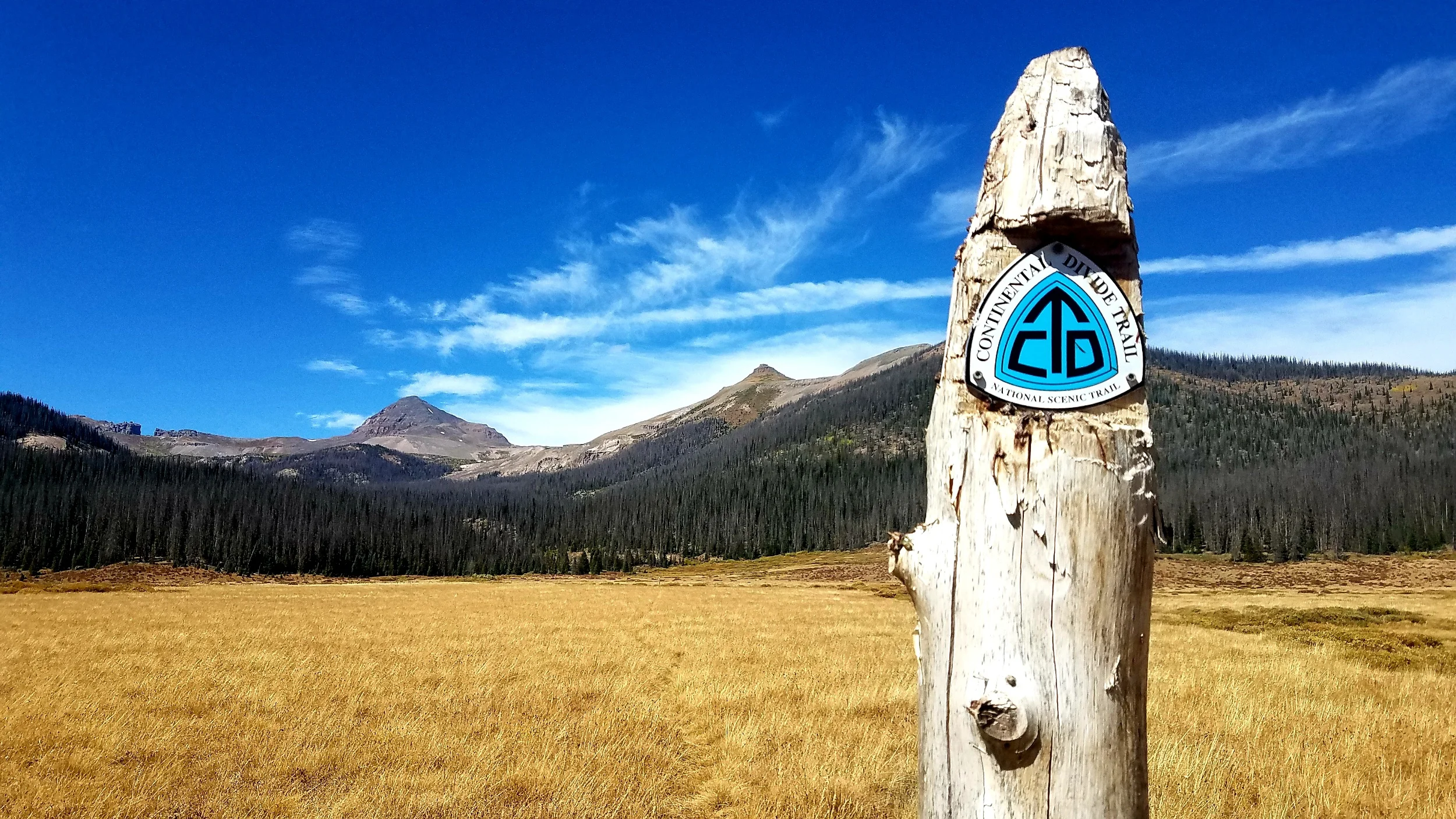
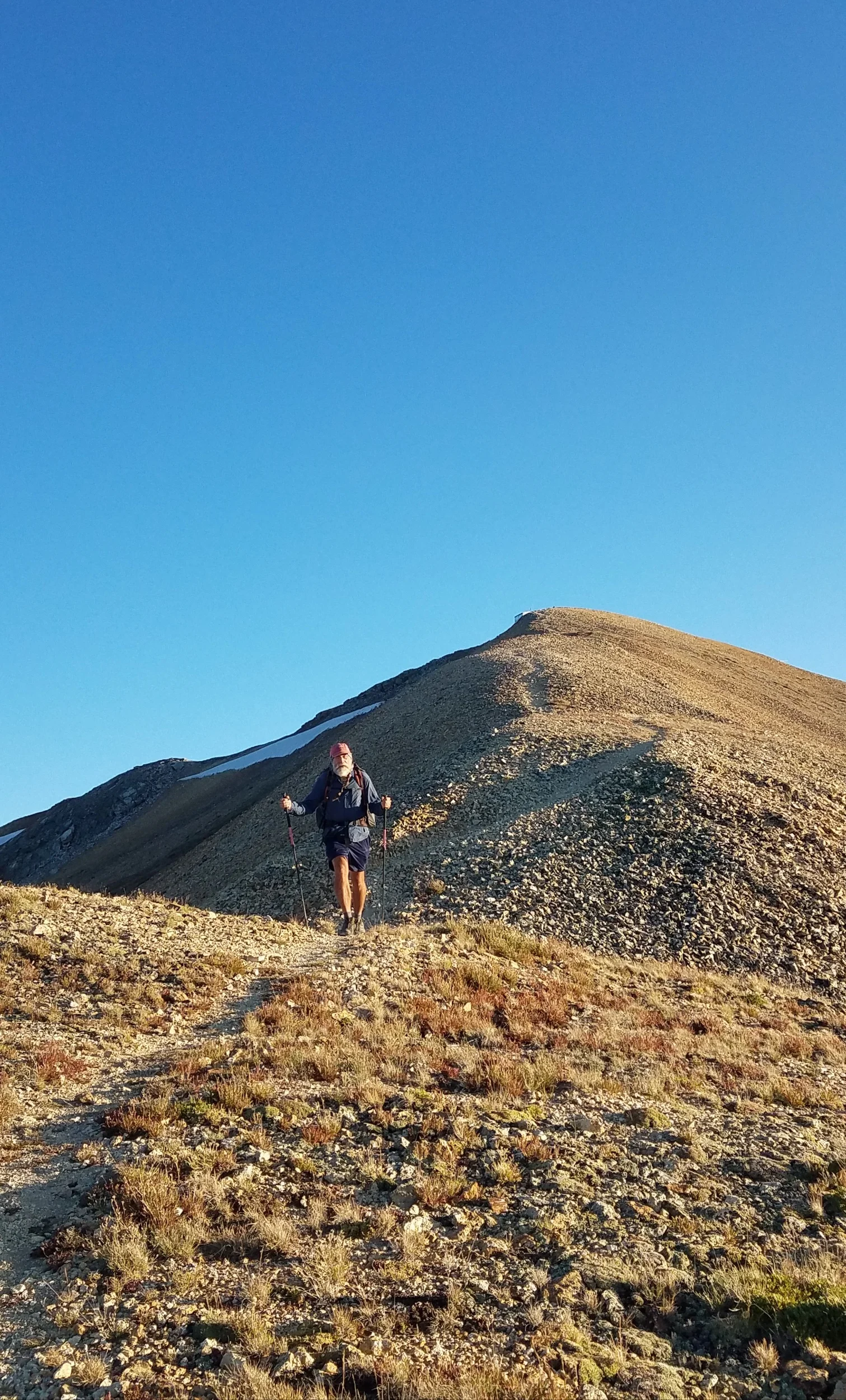
These mountains turned me back in late May and it’s really cool to be back in them now, just strolling through them without a care in the world. I know its super cliche but both the mountains and I have changed dramatically from May to now. On the last night on trail I hiked into dusk to watch my last sunset over the New Mexico mesas in the distance. I heard a wolf howl under the ridge I was walking. Not sure what that means but I'm going to take it as a sign of good luck. I got up a little early to enjoy first light and casually walked to Cumbress pass to meet my footsteps where I got off and flipped in late may.

On October 3rd at 8:31am I completed my CDT hike over 138 days and 2,851.4 miles.

-----------------------------------------------------

Well I have completed another trail and I’m now a triple crowner (I still hate that word). I have walked over 7,700 miles on the three trails so I guess I should be enlightened by now but I somehow passed GO without collecting my 200 dollars.

This trail was special for so many reasons, physically it was demanding and beautiful, it tested my mental stamina and broke me down emotionally on multiple occasions but it also helped me pick the pieces back up.

I dont have any inspirational quotes to share this time around. It was a highly personal journey where I purposefully isolated myself on the trail to reflect on my life and meditate.

At the end of this journey the only thing I can say is that I am okay with everything that has happened in my life up to now and I’m going to be okay with everything that happens afterwards. Did I need to hike a long trail to have that awareness? No I didn't, but I’m okay with that.

Take care, Thanks for reading, and keep your down dry.

Samson-The-Bear

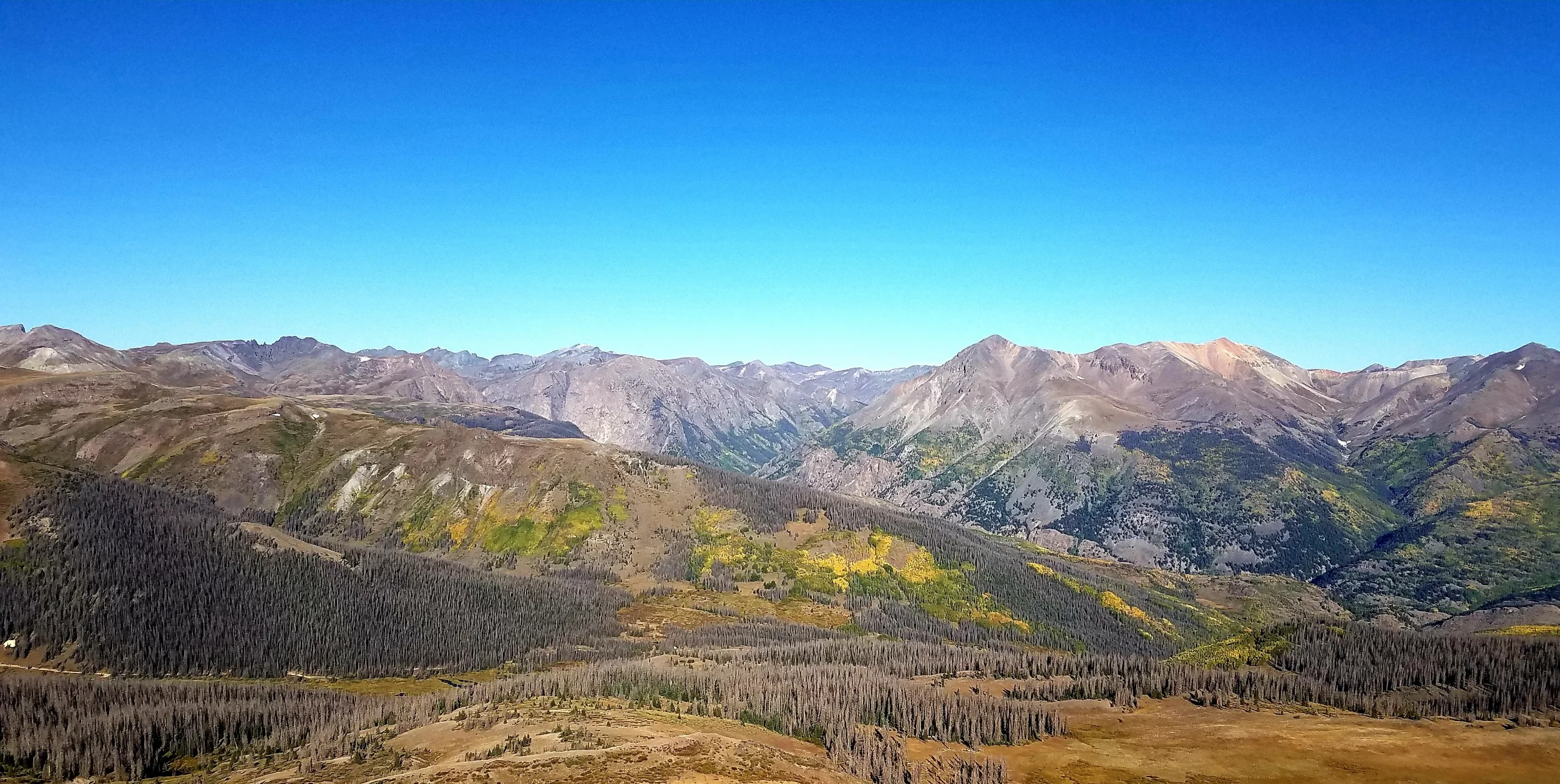
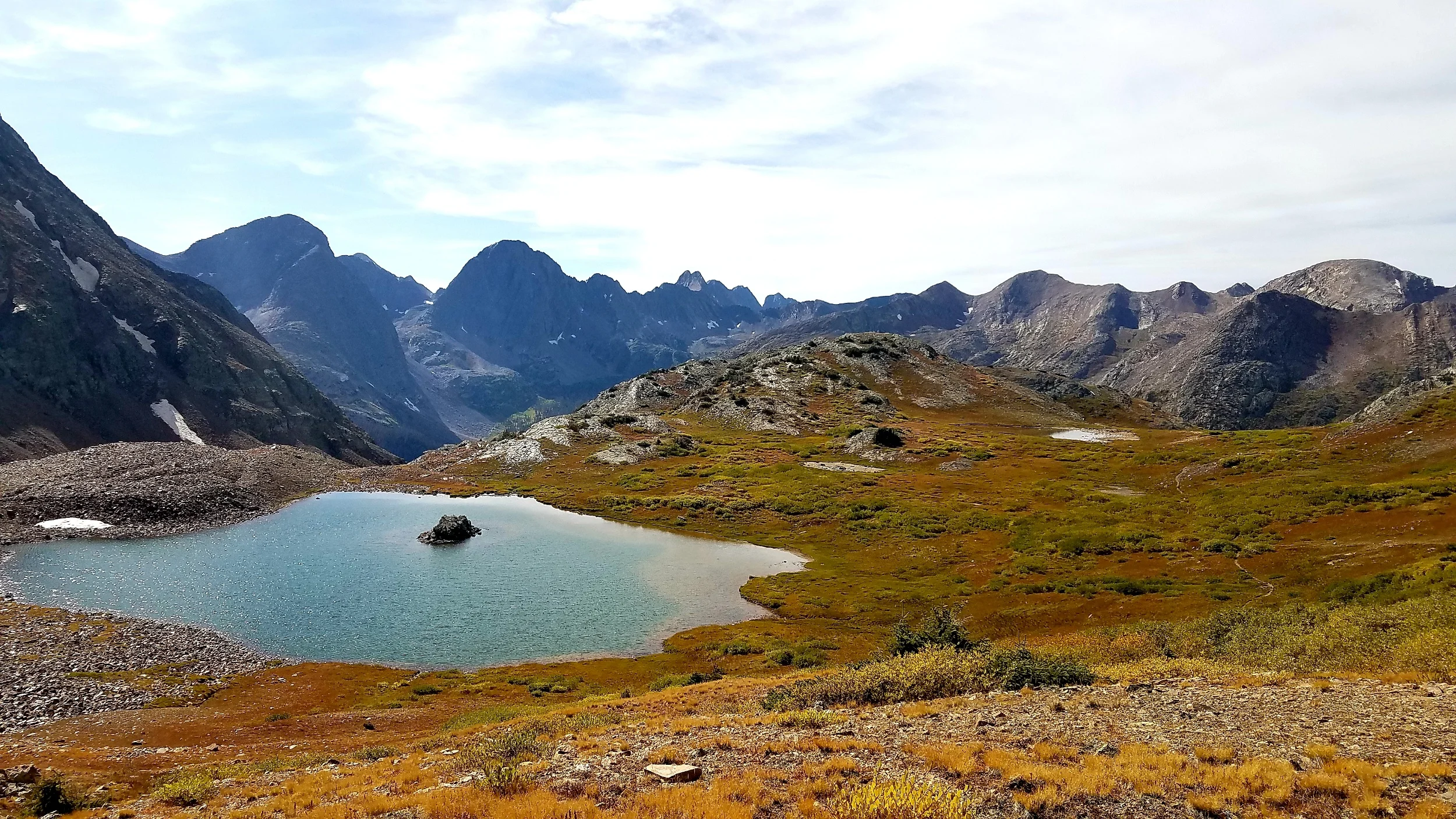
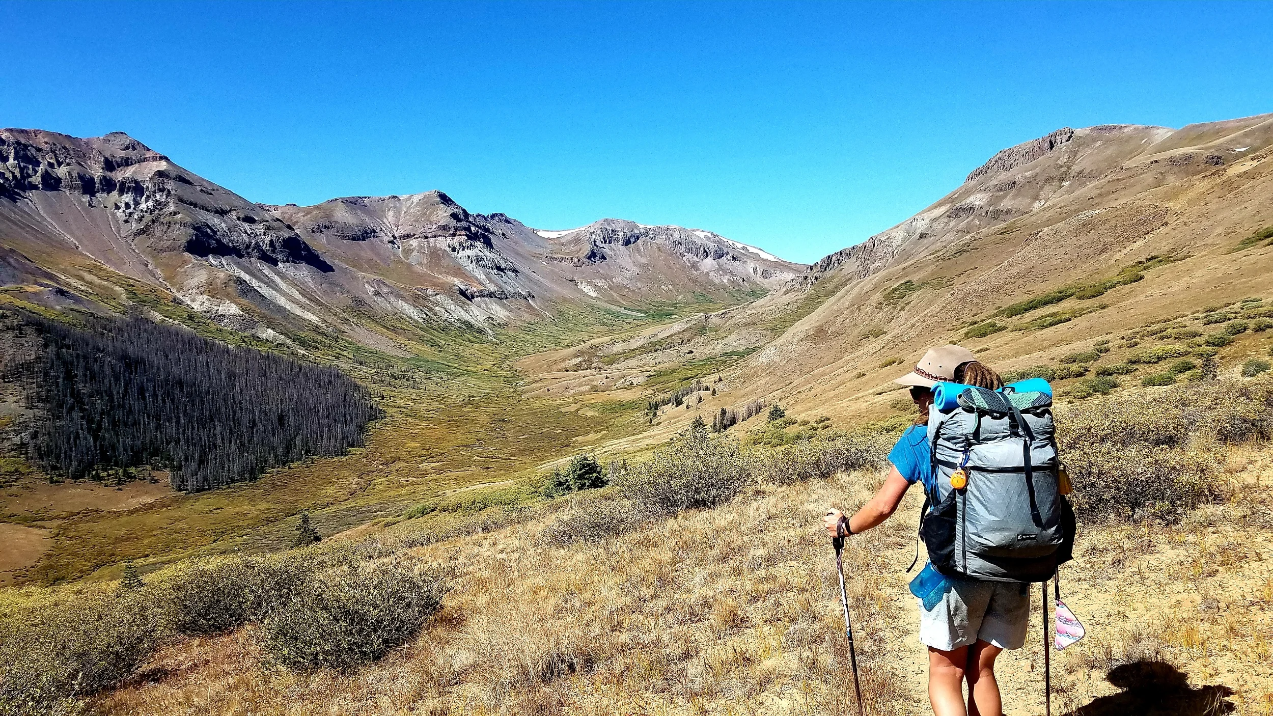
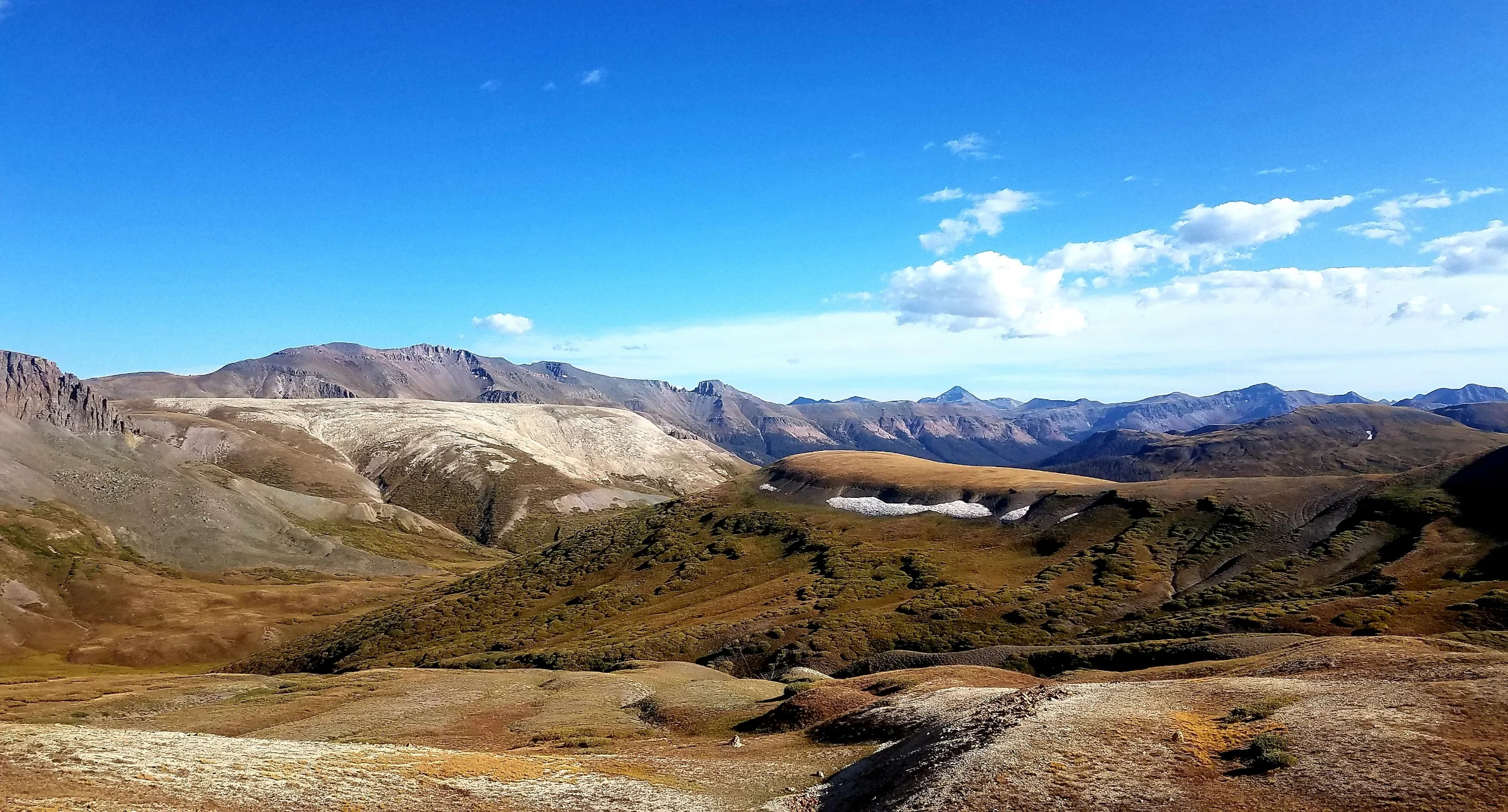
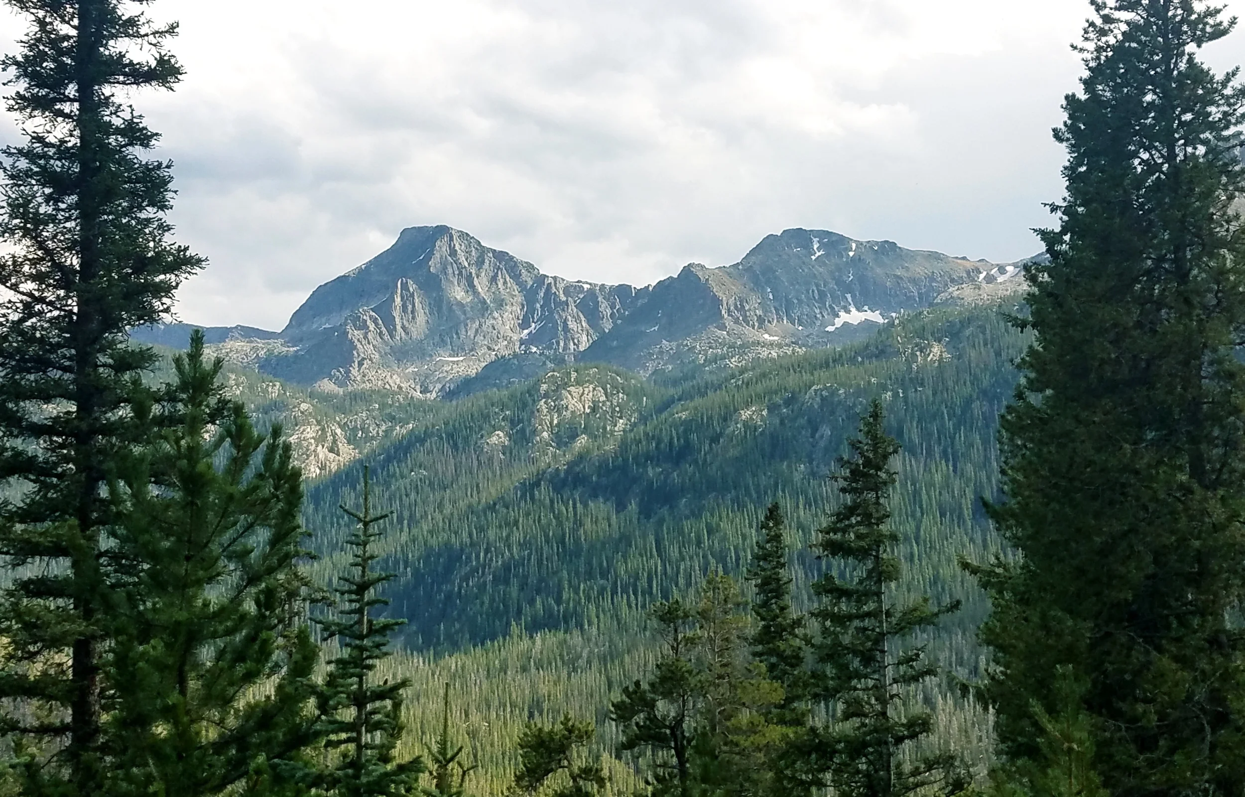
Low San Juan Valley

Low San Juan Valley

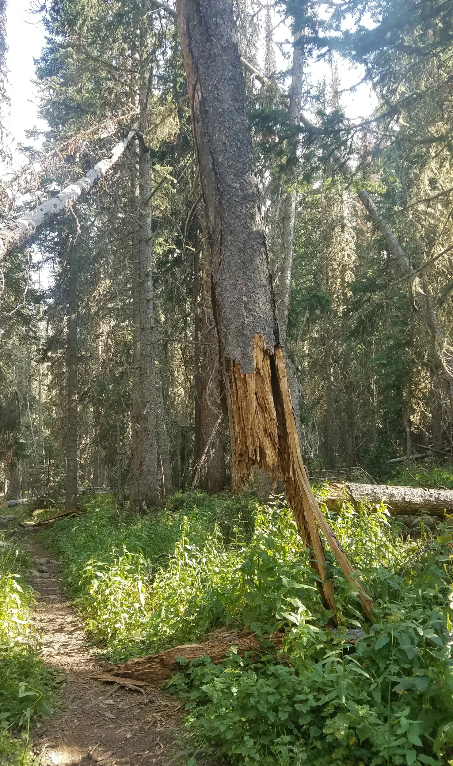
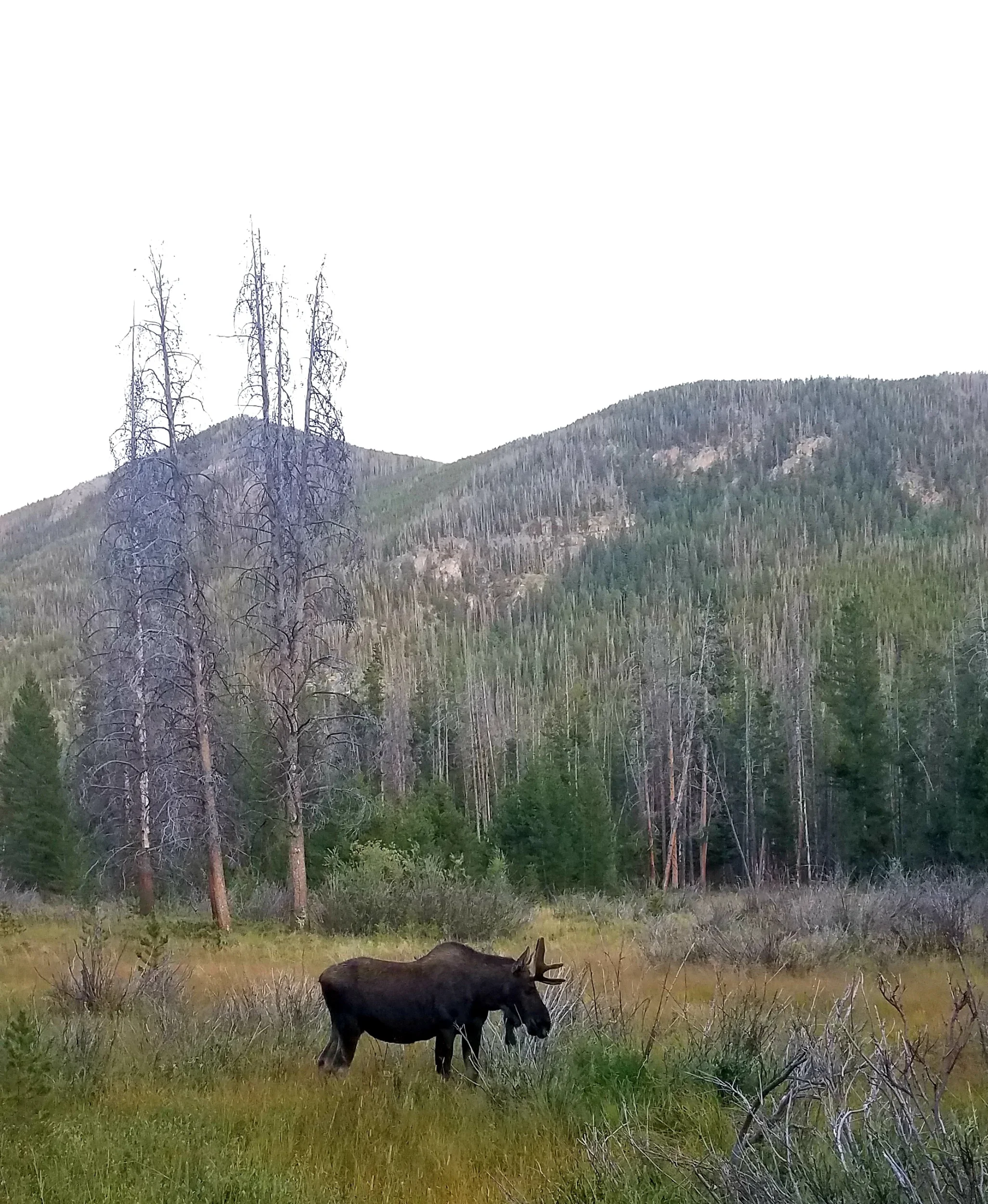
The beetle kill isnt as bad south of Pagosa

The beetle kill isnt as bad south of Pagosa

Overexposed Photo but the plants almost looked like they were little neon bulbs on the hillside

Overexposed Photo but the plants almost looked like they were little neon bulbs on the hillside

Last Sunset on Trail

Last Sunset on Trail

Last Sunrise on Trail

Last Sunrise on Trail

And it's over. At Cumbress Pass

And it's over. At Cumbress Pass

Appalachian Trail 2015Pacific Crest Trail 2016Contiental Divide Trail 2019

Appalachian Trail 2015

Pacific Crest Trail 2016

Contiental Divide Trail 2019

Sea of Castles

On 9/23 I did 9.3 miles to a Mesa past Camp Trail. On 9/24 I did 21.4 miles to a small lake at the headwaters of the Rio Grande. On 9/25 I did 21.5 miles to Ute Lake. On 9/26 I did 21.8 miles to Squaw Creek. On 9/27 I did 21.3 miles to the East Fork of the Piedra River. On. 9/28 I did 18.7 miles just North of Wolf Creek Pass. On 9/29 I did 3.1 miles to Pagosa Springs.

Listen to "Hard Sun" by Eddie Vetter and if you have time listen to the entire "Into the Wild" soundtrack. When Christopher McCandless is brought up it usually elisits two responses; either someone who has wasted his life and received a natural outcome for his actions or someone who was chasing down an idea/dream and paid heavily for a small mistake. It doesn't take a rocket scientist to know I'm in the second camp and I would rather take a few risks and see where it takes me than to play it safe. The end is the same for all of us; whether in a bus in the middle of nowhere or in a nursing home, so you might as well live the life you want to live instead of the one prescribed to you.

I had a blast in Lake City. I got a bunk at the local hostel; I normally go in and out of most towns to save money and time, and as a consequence I don't hang out with a lot of other hikers off trail. The hostel was very chill and only had a few other thru hikers in it. We sat around the table sipping on a couple brews telling hilarious hiking stories and misfortunes and never bringing up the fact we are down to the last 200 miles. I have enjoyed the solitude of this trail and the limited interactions with others, but it felt great hanging out with such a solid group of people.

I hitched out of Lake City in the early afternoon and started towards the San Juan Mountains. For the next 120 miles I'll be at high elevation. I'll spend a majority of the stretch above 12,000 feet, only occasionally dropping to 11,000 feet in a few valleys before climbing back up. It's a giant loop through the San Juan Mountains and the CDT makes sure you hit as many of the highlights as possible. The terrain isn't super steep nor are the climbs huge and rarely more than 1,000 feet of elevation change at a time. I'm just high up in the mountains, meandering through some of the most beautiful terrain in the United States. It's pretty cold especially at night. I have to bring all my gear into my tent to keep everything from freezing; I didn't realize how bad my shoes smelled until I had to share a tent with them. I'm not exactly sure how cold it is in the mountains, but it's cold enough that my electronics won't charge at night and I don't dare start hiking until the sun is up. Because of the cold weather I have shifted when I start and stop hiking. I now hike with the sun and no longer get a headlamp start or night hike the last few miles, its just way to cold to want to move without the sun shining.

Then second night in the San Juans I was kept awake by elk bugeling near my tent. If you don't know what an elk bugle sounds like, find a toddler and ask them to make the most annoying sound they can think of, and that's what an elk bugle sounds like. The next day I popped over a ridgeline to find a herd of elk. There was one massive bull elk and about 10 cows. Off to the side there were two younger bull elks fighting each other. I mixed up some coffee and watched the two go at it for about 15 minutes. It's the most entertainment I've had on trail in awhile. They eventually broke off from fighting which was disappointing because I was hoping it was going to be a death match, so I could have scored some easy and free elk meat.

I knew the San Juan Mountains were going to be epic but I really had no idea just how marvelous these mountains were going to be. I have taken over 400 pictures in 6 days! The San Juan Range is super unique in the diversity of the topography. There are sharp mountains, flaking mesas, spires, jagged ridgelines, balds and pyramids all surrounded by equally diverse valleys. The views are endless and can change dramatically in less than 100 yards as more peaks appear over every ridgeline and down every valley. The tops of even more mountains peak out from every view making the horizon look like an endless sea of castles. Being mostly above tree line I'm not walking through a lot of fall foliage but I can see down the valleys as the aspen and willows change colors. It looks like an artist loaded up their brush with green, yellow, red and orange paints and just splattered the paint across the lower valley walls.

I'm going slow and spending about 7 days in the San Juan range which is a long stretch. I did that thing that I always do, and didn't bring enough food for this stretch (shocking I know). I was rationing my food and day dreaming of a Thanksgiving feast when I ran into a group of elk hunters after hiking over Squaw Pass. They were packing up after an extended hunt and had left over food, which they offered me. I couldn't believe I was getting trail magic in the middle of the San Juans! I was also low on coffee and would rather fight a bear than hike with out caffeine; luckily the hunters had spare coffee to share which made me even more ecstatic. I talked to the hunters for well over an hour. They are professional photographers and serious outdoors men and woman who are able combine both of their passions. We talked gear, hunting and fishing and they showed me a bunch of the their photography work, some of which has been the cover photos for Outdoor Magazine. I could have literally chatted with them all day as they were very down to earth and really interesting but since I have to hike with the sun I had to get moving. Before I left they did a quick alpine photoshoot of me. They used a piece of tyvek to reflect the sun on my face and get the correct lighting, which I thought was super novel (I just hope my face didn't break the camera). I went about 2 miles down trail before I realized I should have snapped a photo with them and Fred, but it was too late to turn back.

I have been sooooo lucky with the weather through the San Juans. In late September anything can happen and I was really rolling the dice by hiking these mountains this late in the season. A huge storm came in the day before I entered and the day after I got out of the mountains. Each day was sunny and warm during the day and cold with rain at night. The rain hitting my tent is probably one of my favorite sounds in the world (as long as my tent is water proof and it stops by morning). I get up every morning to an ice covered tent and break off as much of the ice as I can before packing it up. I pull all of my gear out at lunch to crisp out under the sun which gives me a reason to take an extra long lunch break. I'm definitely going to miss the simplicity of these days.

Looking at three 14ers, Handies, Sunshine and Redcloud. I climbed them last year so I did not feel the need to make a massive detour.

Looking at three 14ers, Handies, Sunshine and Redcloud. I climbed them last year so I did not feel the need to make a massive detour.

This will do for a coffee break.

This will do for a coffee break.

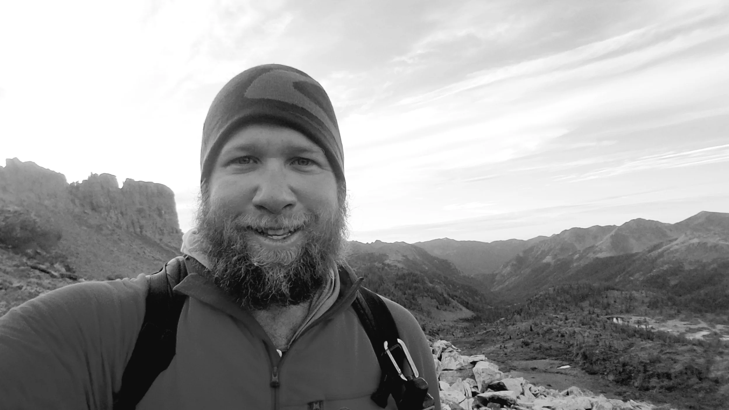
If you take a selfie, just make it black and white and it will be okay.

If you take a selfie, just make it black and white and it will be okay.

The “window” and Rio Grande Pyramid

The “window” and Rio Grande Pyramid

Blazes directing me through a meadow

Blazes directing me through a meadow

The Needle Mountains

The Needle Mountains

Nom walking through Lost Creek Canyon

Nom walking through Lost Creek Canyon

Mt. Ronda in the background, and a bear in the foreground.

Mt. Ronda in the background, and a bear in the foreground.

Not sure where this was, it’s just pretty

Not sure where this was, it’s just pretty

Fall is here

Fall is here

I accidentally got off trail and into the Piedra Creek Valley, but I got a sweet sunset so it all worked out

I accidentally got off trail and into the Piedra Creek Valley, but I got a sweet sunset so it all worked out

Smelling the Flowers

On 9/18 I did 20.5 miles to Tank Seven Creek. On 9/19 I did 22.9 miles to Lujan Creek. On 9/20 I did 22.7 miles to Cochetopa Creek. On 9/21 I did 22.9 miles to a saddle in between mineral creek. On 9/22 I did 9.6 miles to Lake.City.
Listen to "Once In a Lifetime" by the Talking Heads. Where is my beautiful house and my large automobile? (okay we all know I dont care about houses and cars, the real question is how did I get here?).

The section of trail after Monarch Pass has been relatively chill. I am just cruising along the trail bouncing between 9,000 and 11,000 feet and not really noticing any of the elevation changes along the way. It feels like I am in the foothills and actually dropped back down into sage brush country for a stretch, which I thought I had seen the last of back in Wyoming. While I haven't been at high elevation that hasn't affected the views, in fact this has been one of the most picturesque stretches so far; especially going through the groves of aspen which have just started to turn yellow. I have also cut my miles back and have been enjoying my surroundings even more than normal, it feels like I'm out for a stroll more than an arduous hike. The mornings are frosty and cold but the cool air is invigorating and I feel lucky that I'm only walking through cold morning air and not feet of snow.

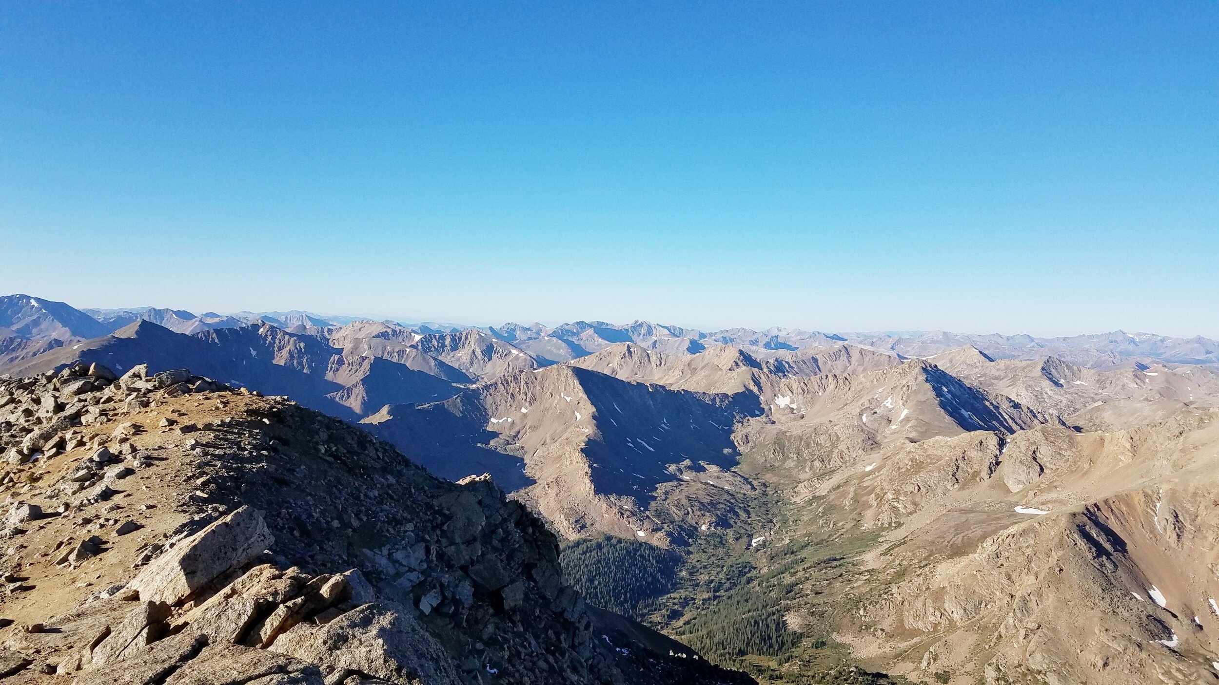
On 9/21 I climbed out of the valley to the base of San Luis Peak. This will be my 5th and last 14,000 foot climb on the trail. I tried to climb every 14er along the CDT. I missed Mt. Huron because I didn't know it was a 14er until I was 10 miles past it and wasnt about to walk backwards, so I'll just have to get it next time. The climb up San Luis was a relatively easy climb over talos fields, the only difficulty was fighting the wind that was cutting through every layer of clothing I was wearing, and trying to blow me off the mountain. The view from the top was spectacular as I got my first glimpse of the San Juan Mountain range which for me is the holy land. I came off the peak and made my way through several valleys and camped on a saddle. I have been camping mostly on exposed ridgelines or deep in valleys near patches of willows because almost all of the trees in this section of mountains are dead from the pine beetle infestation and I don't want a tree to fall on and kill me (about one hiker dies a year from falling trees on one of the long trails). This state was hit really hard by the pine beetles. In other sections of the state I would say 60 to 70 percent of the pine trees are dead; in my current section 100% of the trees are dead.

On the 22nd I went into Lake City for a resupply. I've been asked a lot about my resupply strategy as it has changed from trail to trail. On the CDT I am having a box mailed to me with food to each town I stop in. This strategy works for me for numerous reasons. 1) It saves me a bunch of time in town since I don't have to run around going shopping. Occasionally there is a big grocery store in town but usually most hikers are picking through gas station aisles or general stores trying to figure out what to eat. 2) It saves a bunch of money. A lot of the small mountain towns are pretty expensive and a single cliff bar can sometimes cost $2 which adds up when I eat 5 a day. All of the food mailed to me was bought in advance and was either bought in bulk or at a super low price since it had already expired (yeah I know I'm cheap). 3) I also need special food on trail. I dont carry a stove so all of my food needs to be cold soaked and I also dont eat processed meats so with my unique diet it's just easier to have everything shipped out to me. Having about 30 boxes shipped out to me across the country at very specific times and places only works because I have a solid ATC (air traffic controller) at home. My dad is perfect for the job for numerous reasons. 1) He is retired and can react quickly to my last second requests. 2) He is an extremely detail oriented (perfectionist) person and knows where every box is, its ETA and contents at all times. 3) He generally cares if I live or die and while thinks most of my requests are absurd, he makes the logistics happen.

Looking at the San Jauns from a distance

Looking at the San Jauns from a distance

Cochepota Creek

Cochepota Creek

Uncompahgre and Wetterhorn Peaks in the Distance

Uncompahgre and Wetterhorn Peaks in the Distance

Looking back at San Luis Peak

Looking back at San Luis Peak

Ontop of San Luis Peak

Ontop of San Luis Peak

processed_20190921_201952.jpg
View coming off Monarch Pass

View coming off Monarch Pass

They are finally turning

They are finally turning

In Chocolate I Trust

On 9/14 I did 17 miles to Lake Ann. On 9/15 I did 24.1 to South Cotton Wood Creek. On 9/16 I did 26.4 miles to the base of Bald Mountain. On 9/17 I did 9.3 miles to Salida.

Listen to "Seasons" by Future Island as I meander through the mountains hoping to beat the upcoming seasonal changes.

After resting up in Twin Lakes (ie eating chips and drinking beer) I pushed out of town early. I had two relatively high passes to do that day, Hope Pass and Lake Ann Pass which are both at 12,500 feet. It was a blue bird day without a cloud in sight and I was feeling good even though I had my toughest day on trail the day before. When I got up to Hope Pass I sat down to enjoy the view and have lunch. At the pass I met two new thru hikers Giggles and Tiny Pants. I ended up hiking with them the rest of the day and they convinced me to stop short of Lake Ann Pass and camp at the lake where Joe Dirte was. The 4 of us camped together that night and it was great to have the company and share stories; it was the most people I had camped with since Glacier.

This next section of trail from Twin Lakes to Salida is an elevation roller coaster. The views are spectacular but there is almost no ridge walking, just up and down. I go from the valley floor up a saddle or peak back down to the valley. Unfortunately a storm front has moved in and is keeping me on my toes. I'll hike through any storm until it starts to thunder and lightning. At night I am not just planning where to camp in a safe spot for the next day but also planning bail out points incase the storms get nasty. The weather is changing fast in the mountains and I'm as prepared as I can be.

On the 17th I hitched down Monarch pass to Salida for a resupply. I have driven over Monarch Pass several times on my way out to Gunnison. Last year when I was driving over it I knew I would probably be hiking the CDT the following year and tried to picture what it would be like to cross it on foot. It felt really surreal to reach the pass on foot, I had planned on being on it in mid June but with the flip I'm now on it in Mid September and I'm estatic. I got a relatively quick hitch into town and set off doing my town chores. I wanted to stay in town but at this point in the hike I want to spend as much time in the mountains before the weather turns so I hitched back out in the afternoon. Before I went back on trail I stopped into the hostel to see which hikers were in town. I saw a bunch of hikers whon I hadn't seen in awhile and drank a few beers with them. Several were planning to zero so I had to start saying my final goodbyes. With only 300 miles left on trail the likelyhood of people catching up diminishes. It was great to say my goodbyes but really felt weird. A lot can happen in 300 miles but its going to go in a blink of an eye.

Ontop of Hope Pass

Ontop of Hope Pass

CDT and CT markers

CDT and CT markers

Tiny Pants and Giggles

Tiny Pants and Giggles

Morning View

Morning View

Watching the clouds burn off

Watching the clouds burn off

processed_20190917_103442.jpg
processed_20190917_103353.jpg

Well that’s a Massive Mountain

On 9/8 I took a zero in Gunnison. On 9/9 I took a zero in Gunnison. On 9/10 I did 10.8 miles to Wheeler Trail. On 9/11 I did 23.2 miles to Bennet Gulch. On 9/12 I did 24.4 miles to North of the Highline Trail. On 9/13 I did 30.1 miles to Twin Lakes.

Listen to "Memories" by Streetlight Manifesto. This song sums up the struggle some face when having to decide whether you should stay in your hometown and be surrounded by friends and family or out challenging yourself and going on large adventures.

My body had reached a breaking point and needed a real rest. Luckily I had planned to take a few days off trail once I hit Frisco. I rented a car and drove south to Gunnison to meet up with some friends for 3 days to fish and hangout. It was a wonderful break and great to see some familiar faces; some of the people there I only see once a year during this fishing trip. There was lots of fly fishing, eating, a few beers consumed and a ton of stories told. I took advantage of civilization and made sure to replenish my calories; while I was there I even had a homemade meal that had hiker size portions. I wanted to stay longer than 3 days but I was pushing my luck by getting off trail so I unfortunately had to limit my time off. When I got back on trail I felt like a million bucks completley refueled and ready to go through the second half of the state.

Fall is about to hit anyday now. While the Aspen haven't stayed to turn their magnificent yellow yet there are plenty of other telltale signs. I am having to setup and take down my tent everyday with my headlamp because of the shorter daylight hours; I have to wear my fleece and beanie during the first and last hours of hiking each day as the temperatures have started to drop; and there is a distinctive smell in the air that is synonymous with fall. I am super excited to be in the mountains as the seasons change. One of my favorite things about thru hiking is being immersed in the changing environment along the trail. Unlike living in a city or a suburb, hiking is not a removed process where your surroundings are occasionally viewed from a window but a gradual change that can sometimes be felt by the hour.

While I got a physical and mental recharge during my time off fly fishing I am still needing to consume a ton of calories to keep me going. I am eating a quarter pound of chocolate a day (ontop of all the bars I eat) and drink 4 cups of coffee throughout the day. These additional calories and extra caffeine boosts are going to be what pushes me across the final stages of the hike, i just hope I don't end up with a mouthful of cavities.

The terrain has been constant peaks, passes and valleys one of the valleys and peaks I crossed was Hale Valley and Tennessee Pass which was home to the 10th mountain divison when they trained for 3 years before being deployed in WWII. I couldn't imagine the bitter cold winters spent in this valley. At its peak there were over 15,000 soldiers. Many of the returning soldiers helped start the skiing culture and slopes across Colorado.

I am still having to dodge rainstorms every afternoon and evening. A late storm came in and gave me my first dusting of snow which has started the clock for when I have to be out of this state. I checked the weather forecast for Friday the 13th and saw it was going to be a blue bird day and decided to make a huge push to climb two 14ers, Massive and Elbert. Unlike Grays and Torreys these two 14ers were not connected by a saddle and were two separate climbs. I checked to make sure I had enough calories for this high burn day and made my plans. I was on trail by 5am (after sleeping throug my alarm) and hiking under the stars to the base of Mt. Massive. It took me 3 hrs to get to the top at 14,429'. It was 9am before I started to make my way down the mountain and 1030am before I hit the valley floor in between Massive and Elbert. The trail head forn Elbert was 6 miles away and I was way behind schedule so I drank a liter of water and poured out any remaining water and ran to the trailhead getting there around 1145am and putting me back on schedule. I started to go up Elbert with no issues until I hit treeline where my body decided it had had enough. I started to move slow and finished the last 3,000 feet at a little more than a mile per hour. I got to the top by 3pm. At 14,439’ I was on the highest peak in Colorado. There were a couple at the top who gave me a sign to hold and took my picture. (The sign says 14,440 but they must just have rounded up). I descended to the valley and made my way to Twin Lakes hoping to get some food in town before the general store closed. I was beat; I did about 9,000 feet of elevation gain and hiked 30 miles through some tough terrain. As I was walking into town a guy shouted out to me and wanted to know if I cared to join them for there monthly potluck. We all know what the answer was and I went to bed with a full stomach as I camped in the local park.

Good food with Great Comapny

Good food with Great Comapny

I’m kind of obsessed with Mountain Goats

I’m kind of obsessed with Mountain Goats

Some of the avalanche debris I have to walk over

Some of the avalanche debris I have to walk over

That’s where I wanna go

That’s where I wanna go

First Snow Dusting

First Snow Dusting

View from Mt. Massive

View from Mt. Massive

Elbert Trail Head

Elbert Trail Head

View from Elbert. Massive is on the far right

View from Elbert. Massive is on the far right

processed_20190913_193917.jpg

Happy and Tired

Hanging out and charging at the general store

Hanging out and charging at the general store

Putting it in Low Gear

On 8/31 I did 0.9 miles to Grand Lakes. On 9/1 I did 20.8 miles to a dirt road near Mill Creek On 9/2 I did 20.8 miles to James Peak. On 9/3 I did 22.3 miles to Vasquez Pass. On 9/4 I did 21 miles to the base of Grays Peak. On 9/5 I did 20.2 miles to a random dirt road. On 9/6 I did 23.5 miles to Hippo trail. On 9/7 I did 2.1 miles to Frisco

Listen to “40 Miles from Denver” by the Yonder Mountain String Band. Not only am I actually 40 miles from Denver but this song was apart of what influenced me to hike the Appalachian Trail. When I was in charge of the University of Cincinnati’s Mountaineering Club Gear I would hang out in the gear cave waiting for people to check in or out gear for the week. In the gear cave I had an old school CD player and the only CD I had was a Yonder Mountain String Band CD and I would listen to it everytime I was in the gear cave. There was also a map of the Appalachian Trail in the Gear Cave that I starred at for countless hours. So for two years I would listen to YMSB and look at the map of the AT way before I ever considered actually doing a thru hike. So when I finally decided to hire the AT, and once I was on trail, I considereed this song my hiking anthem.

After completing my loop through Rocky Mountain National Park I stopped into the town of Grand Lakes. I may or may not have been allowed to camp where I was the previous night so I got up super early so I didn't have to have that discussion with anyone. I walked around the empty town until 7am when one of the local restraunts opened. I figured I would grab a coffee and a pastry and set out to do my chores but I ended up walking into a gourmet buffet. I couldn't believe my luck! Everything was made from scratch and tasted amazing. I had 6 plates of food and only stopped because I could see the owner of the restaurant was staring at me. I figured I had gotten my money's worth and waddled down the street to find a laundromat. I spent the rest of the time in town hanging out in the park next to an electrical outlet charging my batteries. I set off later that evening to find the first place I could camp outside of town.

I'm entering a really hard section of trail and ontop of that I'm kind of tired. The first 10 to 12 miles a day goes by pretty quickly but then I really have to concentrate and push myself to keep a good pace after that. Because of the general fatigue and the epic terrain that awaits me I am going to be shooting for lower mileage per day. I'm going to be pushing my luck in the High San Juan's in the Southern part of the state because no one can predict when the first snow will come but right now it feels like I'm making the correct decision to slow down and I hope I don't regret it.

The first day out of town was relatively chill and I hovered around 10,000 feet with abundant water all around. The next day became challenging as I climbed up and stayed at 12,000 feet for most of the day. The water becomes a lot more scarce on high ridgelines forcing me to carry 4 liters of water, and at 2.2lbs per liter you feel every drop. I ended the day with a big climb up to James Peak at 13,310 feet. It was late in the day and I had done my 20 miles so I decided to cowboy camp on the peak since my weather window looked good. I watched the sunset to my west and the Denver Metro area light up to my east. It was really cool being this high up, as this is the highest I have ever setup camp. When I would open my eyes in the middle of the night I could see the milky way galaxy which I hadn't seen since Yosemite on the PCT.

The next day I got up early to watch the sunrise and then took off down James peak to an alternate route. The alternate connects James Peak, Mount Bancroft, Parry Peak, Mount Eva and Mout Flora all of which are above 13,000 feet. It was a beautiful and challenging ridge walk as I roller coastered my way across and over them. On my way up Mt. Bancroft I ran into a mountain goat. This isn't the first time I've seen a mountain goat but they are usually white specks on mountain sides; this one was about 20 yards from me. I watched it move up the mountain for a long time. I've obviously heard the saying "as sturdy as a mountain goat", but until you can get up close and watch these animals move across extremely difficult terrain with finesse and assured movements it's hard to truly explain how amazing their climbing abilities really are.

After coming down Mt.Flora I crossed Berthoud pass and met back up with Joe Dirte who I hadn’t seen since Helena, MT. We hiked together to Vasquez pass over some beautiful terrain as the first storms in this state descended on us. We woke up the next day and B-lined it for HWY 70 where he had a friend come out from Denver to do some trail magic. We hung out in a parking lot for 2 hours and loaded up on calories as we knew the next day was going to be challenging. After leaving highway 70 we started our asscent up the mountain and camped at the base of Grays Peak. The next morning we were going to get an alpine start and head up two different 14,000 foot mountains, the Argentine spine and numerous other mountains before a storm systemhead we knew was rolling in hit us.

We got up at 3am and were hiking under a starry sky by 4am. We had to asscent 2,000 feet up to Torreys peak which we hit around 530 in the dark. We dropped down to a saddle and went up Grays Peak while the sun was coming up. Doing two 14,000 peaks by 630am felt good but was just the start of the day. We dropped over the Eastern Side of Grays to the Argentine Spine. The Argentine Spine consists of numerous large mountains over rough terrain but shouldn’t be missed if the weather window allows it.

We did a sharp ridge walk over to Mount Edward’s where our mileage dropped to about one mile per hour as we scrambled across the ridge fighting a strong cross wind the entire way. We then went up and over Argentine Peak, Dectur Mountain, Revenue Mountain, Silver Mountain, and rejoined the CDT right before Santa Fe Peak. It was a strenuous section full of amazing views, a lot more mountain goats and old mining relics scattered across the ridges. We pushed hard but unfortunately as we were crossing the exposed ridges I could see storm clouds forming and becoming more intense. We continued to push as we were still walking exposed ridgelines at 13,000 feet but when it became clear we were still going to be exposed when the storm hit us we bailed down a gulley for tree cover about 2,000 feet below us. It was a hard descent down a scree field as the storms opened up but it was the absolute right call as the lightning started to let loose. We found a way out of the valley we descended into and back up to the ridge and trail once the storm had passed. It was an epic day that left my body tired but my spirits were high.

The next day I said goodbye to Joe Dirte who was taking an early alternate into towntown because his feet were in a lot of pain (they looked like ground meat (i’m not exaggerating)). I hit a few more 13,000 peaks and descended slightly before hitting the CT. The CDT and the CT share the same trail for 230+ miles. The CT is a popular “short” long trail and promises better trail conditions and signage for the stretch we share. As a side note every long trail in the US shares trail with a “short” long trail. The Appalachain Trail shares trail with the Long Trail, the Pacific Crest Trail shares Trail with the John Muir Trail and as mentioned above the Continental Divide Trail shares trail with the CT.

More early afternoon storms came but since I was below tree line I did not mind. I spent the next day meandering through valleys and hitched into Frisco for a much needed break.

.

Cowboy Camping on James Peak

Cowboy Camping on James Peak

First Mountain Goat after James Peak

First Mountain Goat after James Peak

Hanging out at Vasquez Pass

Hanging out at Vasquez Pass

Sun Coming up after Vasquez Pass

Sun Coming up after Vasquez Pass

Rainbow in the valley before Grays Peak

Rainbow in the valley before Grays Peak

Top of Grays looking out

Top of Grays looking out

Grays Peak from the Argentine Spine

Grays Peak from the Argentine Spine

Sun coming up above Mount Edwards

Sun coming up above Mount Edwards

Not exactly sure where this picture was taken

Not exactly sure where this picture was taken

Delusional at best

Delusional at best

I’m Back

On 8/22 I did 15.7 miles to a ridgeline near Green Mountain. On 8/23 I did 25 miles to Trail Creek. On 8/24 I did 26.9 miles to Newcomb Creek. On 8/25 I did 22.5 miles to Highway 40. On 8/26 I took a zero in Steamboat Springs. On 8/27 I did 24.1 miles to forest road 104. On 8/28 I did 25 miles to forest road 751. On 8/29 I did 20.7 miles to the border of Rocky Mountain National Park. On 8/30 I did 27 miles to Grand Lake.

Listen to "Rocky Mountain High" by John Denver. It feels good to be finished with Wyoming, but weird there is only one state left.

After leaving Rawlins I was technically out of the Great Basin but I was still walking though desert sage brush and drinking saline water under the scorching sun. I ran into my first patch of trees about 60 miles South of Rawlins; I climbed into the small grove of Aspen and let out a hallelujah and took a super long break, it was the first tree and subsequently the first shade I had seen in 180 miles. I have run into a few hikers since then, and that patch of Aspen has come up in almost every conversation. The Aspen not only marked the end of the desert but also the beginning of a forested climb to higher and cooler elevation. Once I started to climb up in elevation I pushed to make it to Encampment, WY to get in before the Post Office closed for the weekend.

I got up early on the 22nd and made it to Battle Pass and started to hitch. It took 35 minutes before the first car came over the pass and it stopped to pick me up. When I have gotten a hitchin MT and WY I always play the "where's the gun game" because I think it is state law in both of those states that every vehicle must be locked and loaded. This particular hitch was too easy since I had to move several rifles out of the way just to sit in the front seat. I think everyone in these states has watched Red Dawn a few too many times. I got into Encampment early and hung out in a tiny coffee shop/antique store while my batteries charged. Once charged up I headed over to the local restaurant where I ate two plates of nachos, two sides of fries, two buritos, a giant slice of pizza, a couple of PBRs and a salad because I need to keep it healthy in town. I never got quite as full as I wanted to but figured I should hitch back out of town and try and make some miles before it got dark.

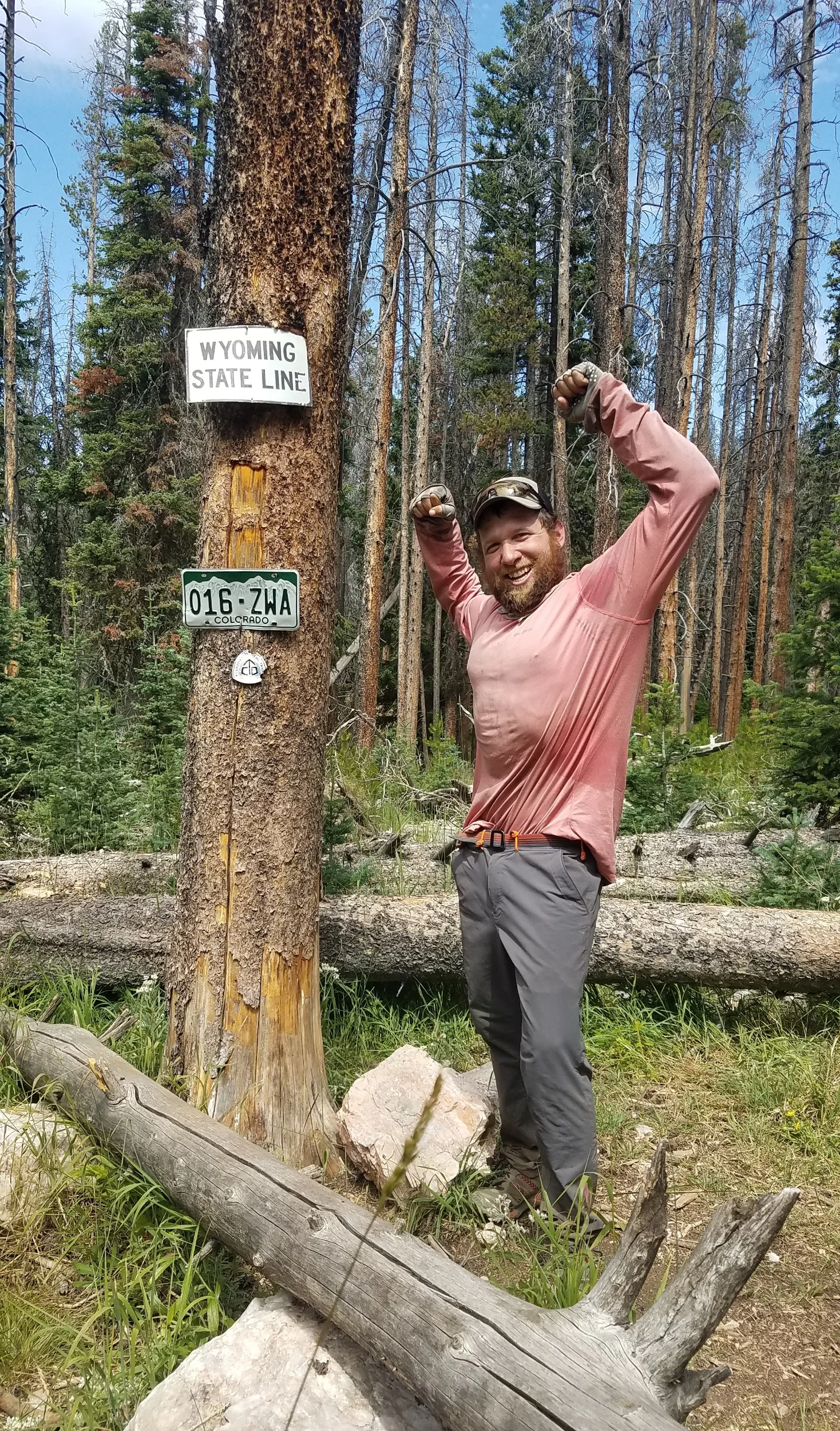
The next day I was walking through the forest where I spotted a license plate on a tree. I had been looking forward to this day for a long time as it marked the state line between Wyoming and its southern neighbor. I was so excited I did a photoshoot (since I mostly hike by myself that involves my trekking poles, rubber bands and my camera timer). I hit the trail hard after the border crossing, mostly because I had mentally prepared myself to hike at 14,000 feet and climb over non-stop jagged mountains. While that time will come, the Northern section of the state is relatively chill. I went over a few 12,000 foot passes but mostly hovered around 10,000 and was below tree line. I crossed a few snow fields and took my breaks at high alpine lakes. It didn't take long for me to forget I was in the desert just a few days ago.

I pushed hard to get to the next town since I needed my tent repaired. The doors on my tent fly no longer worked and when it rained I would have to curl up in the back of my tent to keep from getting soaking wet. My tent is made by Big Agnes which is headquartered in Steamboat Springs so when I hitched in I went to their store to see about a repair. They treated me like royalty when I walked in. They let me take a shower in the back of the building, showed me where I could charge my electronics, and gave me a loaner tent to stealth camp in town while they fixed my tent. Steamboat is super expensive and too costly to get a motel so they let me sleep on their front lawn in the middle of town as long as I setup my tent at dark and took it down in the morning too keep the local police happy. I had to spend two nights in town while my tent was being repaired, but it afforded me the ability to try all of the local breweries.

I got back on trail on the 27th. It started out as an 11 mile road walk which surprised me since I thought I was done with road walks but after the road walk I took a trail gently up into the mountains crossing several high passes. Over the next two days I hiked on and off with two different people, Nom and Max Heap. It was a treat to hike with people as I have been flying solo for so long and rarely see a hiker on trail. After descending the last pass I camped at the border of Rocky Mountain National Park. There are a lot of rules and regulations if you camp in the park so my plan is just to camp at the border, get up early and just walk through the entire park in one day and get out before I have to set up camp again.

Entering the National Park was awesome. I ran into a pack of coyotes, 2 huge mule deer, a bunch of moose and an elk all in the first mile. The CDT through the Rocky Mountain National Park is a horseshoe shaped trail with a solid climb up to a beautiful ridge line and then a gradual descent following a creek. On my way up I was reminded of the brutal winter this area had as avalanche debris was a common sight. Some piles were as high as 30 feet and I'm told down south some of the debris fields are 60 feet tall. As I headed up the ridge line I ran into a heard of about 100 elk just relaxing at 12,000 feet. Since it's a National Park the animals don't have a fear of humans and just started at me as I walked by. After passing the herd I hit the main ridge and got my first long ridge walk. It was an awesome view as I was completely surrounded by peaks. It was a quick up and a quick down, but it gave me a small taste of what the rest of the state has to offer.

Finished with Wyoming

Finished with Wyoming

I’m no Engineer but I think this bridge is out

I’m no Engineer but I think this bridge is out

First Sunset in the new state

First Sunset in the new state

Max Heap coming down Park View Peak

Max Heap coming down Park View Peak

Going down Park View Mountain at Sunset

Going down Park View Mountain at Sunset

I hit the sweet spot in this state. No snow, No Mosquitoes, plenty of wildflowers and water. Just need to get out before Winter hits.

I hit the sweet spot in this state. No snow, No Mosquitoes, plenty of wildflowers and water. Just need to get out before Winter hits.

That’s not safe

That’s not safe

Heading up to the Ridge line in RMNP

Heading up to the Ridge line in RMNP

Herd of Elk in RMNP

Herd of Elk in RMNP

Hey you guys

Hey you guys

He didn’t even care that I walked 10 yards from him

He didn’t even care that I walked 10 yards from him

Coming down from RMNP

Coming down from RMNP

Just Me and My Long Shadow

On 8/14 I did 26.6 miles to Atlantic City, WY. On 8/15 I did 28.4 miles to the middle of the nowhere in the Great Basin. On 8/16 I did 32.9 miles to the middle of nowhere in the Great Basin. On 8/17 I did 37.4 miles to the middle of nowhere in the Great Basin. On 8/18 I did 16.1 miles to Rawlins, WY. On 8/19 I did 17.6 miles to the middle of nowhere. On 8/20 I did 29.3 miles to the middle of nowhere. On 8/21 I did 30 miles to the middle of nowwhere.

Listen to “In 3s” and “Groove Holmes” by the Beastie Boys as I try to groove across the desert.

After leaving the Winds it didn't take to long to hit open country. I'm am walking through a large empty expanse called the Great Basin. If you were to look at a map of the geographical contiental divide you would see it actually splits into 2 after the Winds and rejoins around Rawlins, WY. This split forms a basin where any water that enters it does not flow out of the basin. You may think an area that holds its water would be lush but I assure its not and I had to keep checking my maps to make sure I didn’t accidentally enter the gates of hell.

After leaving the Winds I resupplied in South Pass City. Wyoming is super liberal with their usage of the word city. I think it had a population of 20 people and the only thing going for the “city” was an abandoned mining town that was reconstructed as a historical site and a gift shop that accepted hiker packages so I was able to pick up a package there and push on. I needed some food and since a town of 20 cannot support a restaurant I went to the next city over to grab some grub. I walked 6 miles to Atlantic City, WY which was a comparable metropolis, it had a population of about 57 people. I walked down main street and could have put my tent up in the street and not worried about a car hitting me. Eventually we ran into a local who was picking up his mail on his motorcycle with a side car on it. We chatted for a few minutes and I told him it would be a dream hitch to get picked up in a side car to which he replied "jump in". The drivers name was John and he rebuilt an old BMW motorcycle from multiple bikes and said he had parts on the bike ranging from 1953 to 1961. He took me on a tour of Atlantic City and up on the surrounding hills. We rocketed down the street and up and down all of the dirt roads, I held on for dear life when he would make left hand turns as the side car and I went into the air. Unfortunately the town was so small the tour only lasted 10 minutes but it was a blast. He dropped me off at the local bar where I went in for some much needed sustenance. There wasnt much to do in town except have a few beers and talk to the locals. I could see the sun was starting to go down so I closed my tab. When I told the bartender I had to get going to find a campsite she just laughed and told me to setup my tent in their front lawn. This isn't the first time I've slept at a bar, but it's the first time I didn't get I trouble for sleeping at a bar.

The next day I got up early and pushed out. The early mornings and very late evenings are the best time to hike the Basin because there is no shade; my shadow is long during these times and is about the only thing keeping me company through this desert. I tried to hike with my umbrella for shade but the wind was too strong to use it. I went on a 60 mile stretch in the Basin without seeing anything resembling a tree not even a large shrub, nothing but short sage brush for as far as the eye can see, which is pretty far since it was so flat. I could easily see 15 miles away which is kind of a problem when you need to dig a cat hole. There is no tree or hill or anything to hide behind, you just have to risk it and hope there isn't a funny story to tell later.

While I was in very desolate environment. I did run into a few people I knew. I ran into Macro who I hadn't seen since Pie Town. He was heading North and we exchanged what we did to get around the snow and exchanged information for upcoming sections; I could tell he was in a hurry which is understandable since he has a fair amount of miles left to do before winter hits Glacier NP. I also ran into Dust Buster and Chisel who were also heading North. I met both of them 3 years ago in Washington State on the PCT. We laughed how strange it was to meet people we hadn't seen in 3 years in one of the most barren places we had ever been. We talked for an hour which none of us minded since it was the heat of the day and any excuse to not hike was a good one. The most important pieces of information we exchanged was about water. Being such a desolate landscape finding water was super important and what water was there was super sketchy. In the basin there are a lot of cows who love to shit in the water sources and once you get south of Rawlins a lot of the water sources are saline and have high alkalinity which will make you dig a lot of cat holes if you drink brine water. With the shitty water situation (pun intended) it was good to get first hand information on what water sources were reliable and which ones were going to stink.

Once I said my goodbyes to Dustbuster and Chisel it was just me and my 4 legged friends. While hiking though cow country is certainly nothing new I was in prime Prong Horn Sheep country. I easily saw over a thousand of them and some of the groups moving across the planes reminded me of gazelles running across the Serengeti. Along with the pronghorn I also ran into a lot of wild horses who aren't the least bit afraid of humans and will come into camp and check you out. Not nearly as dangerous as a grizzly but a few years ago a hiker tried to pet one and it bit his arm so hard it broke his bone.

The Great Basin was definitely hard. The water was rough, the sun was hot and I decided to make it harder on myself by running out of food. I thought I would have gone faster through the basin but the sun sapped the energy out of me so I ended up taking a half day extra to get to Rawlins, WY. That about last 18 miles I didn't have any food. I wasnt a happy camper and pushed hard in the early morning to town so I wasnt beat down by the sun. I decided to get a motel and spent the next 24 hours in town eating sugar and drinking water; it wasnt the most exciting town stop but it was a much needed rest before I start to gain elevation and get back into the Rockies.

processed_20190822_102824.jpg
It’s not so ugly as long as you have food and water

It’s not so ugly as long as you have food and water

Pronghorn on the horizon as the sun is setting

Pronghorn on the horizon as the sun is setting

That’s my trail for miles and miles

That’s my trail for miles and miles

The Great Basin

The Great Basin

I hope there is water out there

I hope there is water out there

Gaining some elevation with the last light of the day as I head towards Encampment

Gaining some elevation with the last light of the day as I head towards Encampment

And It Keeps Getting Better

On 8/9 I did 6.4 miles to the Green River. On 8/10 I did 23.2 miles to the North Side of Knapsack Col. On 8/11 I did 21.3 miles to Ramboud Lake. On 8/12 I did 25.5 miles to just South of Texas Pass. On 8/13 I did 23.3 miles to a cross roads near Sweat Water River.

I had a relaxing time in Pinedale, WY. I stayed in the basement of a church and was able to get all of my town chores done relatively quickly leaving plenty of time to catch up on sleep, hang out with a few Northbound hikers and sample the local brewery. I almost took a zero and stayed another night in town because it was such a chill place but since the hitch back to trail was a long one to a relatively remote trailhead I figured I would have better luck getting out there on a Friday evening and try and catch someone who is planning to spend the weekend up at Green River Lake. It took 4 hitches but within 2 hours I was walking back along the Green River exactly where I had swam across it the previous day.

I entered the Briger Wilderness and into what is known as the Wind River Range or as most hikers refer to it as the Winds. The Winds have a very lush forest and raging rivers that gives way to jagged mountain peaks and endless views. There are so many "trails" in the Winds you could seriously spend a lifetime exploring them. I put trails in quotes because all of the trails in the forest are will maintained and easy to navigate but once you go onto the higher elevations you need to have navigation skills because there isn't really a trail. The Winds can hold snow for a long time and can be super dangerous so there is really only a few months out of the year you can explore the high routes. The CDT takes the low routes through the Winds because of the snow risks but there are several opportunities to jump up to the high route. If the snow season had been smaller I would have taken the high route all the way through the Winds (probably would have taken 2 weeks to pull it off and a ton of map studying) I really hope one day I can explore the high route as it is one of the most epic hikes in the United States. Since the snow is just starting to melt out completley and I took the Teton alternate, I'm going to stick to the CDT but take two other alternates up to the high route.

The first alternate I'm taking is up to the Knapsack Col. It was a long rock scramble up to Rock Pass that slowed me down to less than 1 mile per hour. I made it through the rock gulley and skirted a beautiful alpine lake before starting my approach to Knapsack Col. I knew I was going go be moving slower in the Winds but didn't realize how slow. I had planned on going over Knapsack on my first day but as the hours passed I decided to not push my luck and camped about 1,000 feet below it. It feels great to be camping at elevation again surrounded by jagged peaks. Knowing I'm going to be moving slower I'm going to be getting up much earlier.

The next day I tried for an alpine start to catch the sunrise while on Knapsack Col. When I was about to deflate my mattress I saw a flash of light. I was hoping it was from a hikers headlamp passing by but a few moments later I heard the thunder clap bounce off all of the mountain walls. It was still pitch black out so I had no idea where the storm was or where it was going but shortly thereafter my tent started to shake violently in the wind and a huge storm rolled in. I had to just wait the storm out. Even though my tent was shaking like a leaf in the wind and the thunder echoed off the canyon walls for what seemed like minutes, I was able to catch another hour of needed sleep. By the time I could tell the storm was dissipating it was already 7am. I quickly packed up and started for the saddle when it started to snow on me (I have now been snowed on in every state on the CDT). I got to Knapsack Col and took in the magnificent views. I was only on the saddle for 10 minutes before I saw some impressively dark clouds coming my way so I made a quick move for the other side of the saddle. There wasn't an obvious way down, it was super steep and glacieated. Instead of taking a rock scramble down I decided to glissiade down the Glacier. Once I lost about 600 feet of elevation in 20 seconds I made a B-line for Titcomb Valley. I got rained on pretty hard as I moved out of the valley. I got some cool views as I was coming down, but the storm definitely obscured my views from the top and pushed me to lower elevations quicker than I wanted. By the time I left the valley the sky became blue without a hint of storms; ohhh well I'll have to catch this section again when I come back someday for the high route.

The next day I had blue bird skies as I rolled through the Winds. It was a chilly morning and I hadn't been this cold since Glacier NP. I moved quickly through this section crossing by a stream or lake every 10 minutes with granite mountains dotting the landscape. My next goal was the Cirque of The Towers on the high route. Having gotten run off Knapsack Col, I wasn't going to pass up the clear skies and made my way for Texas Pass. I cleared Texas Pass by 7pm and found a spot to pitch my tent underneath the impressive towers and watched the sun disappear behind the spires. I was relaxing in my tent and dozed off to sleep but woke up around 830p with the moonlight piercing through my tent. I stuck my head out of the tent and saw the entire valley being illuminated by the moon so I naturally jumped out of my tent and snagged some pictures. I sat for an hour with half my body inside my sleeping bag and the other half outside the tent watching the moon cross the sky. I had to catch some zzzs but I could have stayed up all night watching the sky.

The next morning I got up early to catch the alpine light off of the rock faces. I was not disappointed walking under the giant towers as the morning sun lit them up. I continued up over Jackass pass and took an alternate on the alternate to Deep Lake. On my way up to Deep Lake I walked on a slab of granite for about a mile which was angled at a gentle 30 degrees. As I ascended the gentle slab I came upon a new basin which was surrounding Deep Lake. I took my coffee break in the shade of a boulder as I looked up at the huge rock faces. I pulled out my map to identify the peaks and realized one was the East Temple Peak which I had heard you could climb up the backside of. As I headed back to trail I found a route on my maps that took me up East Temple, so I blew my schedule for the day and went for peak. It was a long climb but once I got to the top I could see almost the entire range Wind River Range from 12,500 feet. I could see at least 15 different ridge lines stacked ontop of each other and a dozen alpine lakes. It was the highlight of the Winds and a showed me how much more I have to explore. As I was coming down East Temple and took a snack break. My food bag was nearly empty and I still had 38 miles to do before my next resupply so I pushed hard out of the Winds, keeping my head down before I found another mountain to climb.

Cirque of the Towers in the alpine light

Cirque of the Towers in the alpine light

Catching a Glimpse of the moon coming over the Cirque

Catching a Glimpse of the moon coming over the Cirque

Deep Lake. The angled mountain in the back is East Temple

Deep Lake. The angled mountain in the back is East Temple

Indian Basin

Indian Basin

Coming down Knapsack Col before the storm hit

Coming down Knapsack Col before the storm hit

Fred on Knapsack Col with the storm in then background

Fred on Knapsack Col with the storm in then background

View from the top of East Temple Mountain

View from the top of East Temple Mountain

Heading into the Winds from Green River Campground

Heading into the Winds from Green River Campground

Heading up to Jackass Pass

Heading up to Jackass Pass

Coming Down Sandy Valley

Coming Down Sandy Valley

Entering Titcomb Basin after decending Knapsack Col

Entering Titcomb Basin after decending Knapsack Col

Coming down Jackass Pass I found this lake.

Coming down Jackass Pass I found this lake.

The Gros Ventre You Say

On 8/5 I Did 15.7 miles to Cable Creek Trail. On 8/6 I did 25.8 miles to Granite Creek Trailhead. On 8/7 I did 28.2 to Kinky Creek Trail. On 8/8 I did 16.4 miles to Green River and Hitched to Pinedale.

Listen to “Green River” by CCR. I doubt this is the Green River they were singing about but its still a great song to hike to as I approached the Green River.


I woke up in a cloud at the Phillip's trail head with all my gear soaked, this wasn't ideal but happens from time to time when moisture gets trapped in a valley that I decided to camp in. I packed up all my wet gear via headlamp and was walking by 430a. I had an 11 mile road walk to get into Jackson, WY and wanted to get out that evening with all my chores done because I literally could not afford to stay in town. I actually dont mind road walks into town anymore because it gives me a chance to call friends and family while I'm walking and I don't have to ration my battery usage since I'll soon have access to outlets in town.

Jackson was a weird town. The locals were super cool and gave me great advice of where I could hang out and get my chores done away from the tourists. All of the tourists looked like a copy and paste experiment that went wrong; They all had Patagonia hats on, unflattering khaki shorts a tight fitting polo and all looked fatigued from carrying all of their recently bought knickknacks from the local western store. I'm giving Jackson a hard time, but I get why people come here. There is a bike trail that takes you from downtown Jackson to Jenny Lake in the Tetons. If I lived in Jackson I could ride my bike as part of my alpine start of the mountains. That's pretty cool and I would probably have a hard time keeping a job in town since there is so much climbing, hiking and fishing within riding distance.

I left town Jackson via a mountain bike trail as I headed towards the Gros Ventre Wilderness (Its pronounced Grow Vant). My detour off the CDT can basically be broken into 3 sections: Yellowstone NP, Teton Crest Trail and the Gros Ventre Wilderness. I had no idea what to expect in the Gros Ventres but was so suprised with how gorgeous they were. The Gros Ventres are known for having the most landslides anywhere in the United States which gives way to so many cool rock formations that are constantly changing. The hiking through the wilderness was chill I went over 3 big passes and then spent the rest of the time following small rivers as they snaked through the valley. It was a very enjoyable section and I only had to bushwack and go cross country a handful of times which isn't bad when you are making up the trail as you go.

I hardly saw anyone in the Wilderness, the first person I saw was a backcountry ranger. I spoke with her for a long time about everyone's favorite subject: Bears. I told her I hadn't seen much bear sign in the Gros Ventres and she just laughed. She told me that I need to look for more than just paw prints and scat and that the Gros Ventres are actually at carrying capacity with Grizzlies. We talked for awhile about different tell tale signs of bear activity and once I knew what I was looking for I could see signs everywhere. For instance I was looking for claw marks on trees, I was looking at eye level for the marks, but a standing grizzly can reach 8 to 10 feet, so once I looked higher on the trees I saw a bunch of claw marks everywhere I looked.

I ran into a few cool animals in the Gros Ventres. The first new encounter was with a badger. I couldn't figure out what it was at first since I had never seen a badger in the wild but once I realized what it was I gave it plenty of room because badgers can be pretty aggressive if they feel threatened. The second wildlife encounter was with a golden elk. I came across it when I was bushwacking and it was in a dense forest. It was the biggest elk in had ever seen with a huge rack and was golden in color. It looked almost mythical and I was hoping it was going to give me some sage advice but instead it just ran off.


While the bushwacking in the Wilderness was low I was completely off trail once I left the Wilderness and was crosscountry hiking. It required a lot of navigation and "let's see what happens" route decision. I did a pretty decent job of making my way towards the green river campground where I planned on doing a hitch to Pinedale. The hitch to pinedale is a 50 mile hitch on a road that is not very busy. As I was making my way to the trail head I was actually going to be parallel to the road I needed to hitch out on for 8 miles but the Green River was in between myself and the road. It seemed silly to be so close to the road and miss the few potential hitches along the way. I decided to swim the Green River. So with my pack above my head (luckily it was light because I was out of food) I swam across the river. I popped out the other side and climbed the embankment right as a horse trailer was going by; I stuck out my thumb and they pulled right over. I was still sopping wet as I jumped in the back of the truck and made my way to Pinedale.

Granite Creen

Granite Creen

20190809_102031.jpg
Flowers after a fire

Flowers after a fire

Shoal Falls

Shoal Falls

Going down to the Gros Ventre River

Going down to the Gros Ventre River

Gros Ventre from a far

Gros Ventre from a far

Claw marks high in the tree

Claw marks high in the tree

I Cannot Believe I'm here

On 8/1 I did 26.3 miles to just south of Lake Solitude in Teton NP. On 8/2 I did 18.4 to South Fork underneath the Middle Teton. On 8/3 I did 14.7 to the Alaskan Basin. On 8/4 I did 20.6 to Phillip's Creek Trail Head

Listen to “Gettysburg” by Ratatat. This song pumps me up and is what I listen to when I'm about to do something fun.


As I was making my way towards the Tetons I had to stop and triple check my maps to make sure I actually had to go over Littles Peak to get to my next waypoint. It was only a 1,000 foot climb from where I was standing but it was pure talos rock. This is a huge pain because all of the rocks are unstable and you never feel steady as you walk over them, plus it's a great way to break an ankle by getting a foot stuck in between rocks and falling. Unfortunately there wasn't a detour and I had to go up and over. I took my sweet time climbing over the scree and talos and when I got to the top I got my first epic view of the Tetons!

The Tetons were breath taking. I was on a super remote plateau looking at them from the West. I wanted to stay there and soak it in but a huge storm was coming my way. It was not a straightforward route to get from the plateau down to the basin below me. I got turned around a few times in my haste but could use the impending storm as an indicator of where West was. I made it to a steep ridge after crossing several knife edges and slowly descended down toward Lake Solitude. The only thing worst than going up a talos field is going down a talos field. It took me 45 minutes to decend as the skies started to open up. It didn't bother me because everytime I looked up from my feet I got the most spectacular view of the Tetons.

Once in the National Park the trails are super well maintained and I found a campsite about 2 miles South of Lake Solitude. The next morning I got a headlamp start to Jenny Lake. I ran into a few moose in the morning who didn't seem to be bothered by my presence. Once at Jenny Lake I went to the ranger station to get permits to climb the Tetons. When I explained to him where I came from and what I wanted to do in the Tetons he just smiled and said it was an awesome plan and he was a little jealous (anytime you can make a backcountry climbing ranger jealous you are doing something right). We reviewed my plan which includes me climbing the Middle and South Tetons from the East but then down climbing from the West which as he put it "I've never heard of anyone doing that but I think its possible". He seemed enthused with my plan and didn't try to talk me out of it, but it start to make me wonder if I bit off more than I can chew.

After getting my permits I had to hitch to a small town called Moose, WY to pickup a resupply package from the Post Office. I got a quick hitch there and back (it's all about the pink shirt, but the pink shirt is kind of looking brown because I haven't done laundry for 2 weeks). With a resupply on my back and permits in hand I headed towards the Tetons.

Once I started up the main route to my high camp at South Fork at 10,000 feet, I saw a bunch of climbers coming down after they had summited that day. They all had high end and fancy gear hanging off of them that I didn't have. Now I started to get a little worried. I am wearing trail runners, have carbon fiber hiking poles and the gear I have is supposed to go the distance but not necessarily the altitude. I start to wonder if this is a good idea, but while my mind is spinning I notice that I am effortlessly passing every climber that is also heading up to the high camp. They look out of breath and I'm just trying to be polite while getting around them. They maybe wearing 500 dollar fleeces but I've been moving in the mountains for the last 75 days and it shows.


I spent the night on the South Fork of the Middle Teton and had an awsome view of the South Teton from my tent. I still had plenty of day light left when I set up camp and just relaxed the rest of the evening. I got up the next day at 5am and was packed up and heading up to the South Saddle by 6am. I did not do an Alpine start because I wanted to give the snow fields a little time to soften up before I got on them. I reached the South saddle by 7a and started up the Middle Teton. I was moving fast and having a blast. There was a large snow field I had to put my spikes on to climb up. I then hit a short plateau before I hit the South Couloir which will take me to the summit. I was inside the couloir when the climb got difficult. I was hand over hand climbing, stemming and hand jamming my way up with a full backpack on. This was definitely class 5 climbing and had some consequences if I fell. This was very different than the route information I had received and I was a little caught of guard but I managed to pull myself up and got to the top of the mountain and take in the views of the Grande and South Tetons. I was not looking forward to the down climb when I saw a different route than I came up on. It was a much easier route and should have been the route I went up (this is what I get for climbing by myself and without any solid climbing beta). It was smooth trip back down to the South saddle. As soon as I hit the saddle I ate a few snickers bars and went straight for the South Teton. It was a rock scramble all the way up with a small snow field that was easy to navigate. I was moving quick. I had been thinking about and planning these 2 climbs for months and I was finally doing them and was bounding with energy. I got to the top of the South Teton by 1030a with no issues and started to down climb as I tried to figure out my route down the west side of the Mountains.

To get to the western side of the Tetons there was a spine I could follow down on the South Teton but I had to get around a lesser peak in order to get onto the spine. I could either circumnaviagte the peak from the north or from the south. I choose the south and ohhhh man did I choose wrong. I quickly got into some technical climbing as I was going around the peak. There was a sketchy 40 foot down climb I had to do. I made it about 10 feet down before I decided I couldn't do it with my pack on. The climb was in my ability range but having a fully loaded pack with 6 days of food in it was making things very difficult. I climbed up to a ledge and pulled out my food bag which had my bear hanging rope in it. I tied one end to my pack and used a corner of a rock as a shive to lower my pack down. I then down climbed the face. Once down the face I was in a chute filled with rock features and loose stone. I started to head down the chute trying to find the best way down to the valley floor. The number one rule when decending a route un-roped that you didn't come up is: don't go down anything you cannot see the bottom of because there maybe a cliff face you cannot see. With this in mind I was climbing over to different chutes along the backside of the mountain until I found one that I could see the floor of. It was a long scree field that eventually met up with the western spine which connected me to the trail I wanted to be on. I was so happy I kissed the trail when I hit it. Two mountains and a new decent all by noon! I felt like a million bucks. The Tetons were so grand, I had taken a 100 mile detour to do them and it was worth every step.

I walked another 2 miles down the trail found a tree to sit under and opened up my pack to make lunch. When I opened my pack I wondered "Where is my tent?”. I dumped my pack out but there wasnt a tent in it. My mind started to race and then my heart sank, because I knew exactly where it was. It was on the ledge where I had to lower my pack. My tent was ontop of my food bag in my pack so I had to take it out to get my bear hang rope and did not put it back in.

I went through all of my options and none of them were good. I had to have my shelter it's one of my most important pieces of equipment second only to my feet. I had to go back up the trail, up the scree field, find the chute and climb back up the sketchy section and retrieve the tent. It wasnt even 1p so I had plenty of daylight left, I was tired and the thought of another 3,000 climb wasn't ideal but being without shelter was not a possibility I was willing to entertain. I popped a few cliff bars in my mouth and headed back to the Western spine. The first two trail miles flew by as I was working off of adrenaline. I then hit the scree field where my pace slowed down. It was at a relatively high angle and for every 3 steps I took up the field I slid down 2 as the rocks slipped under my feet. I had to be super stategic with my foot placement so I didn't burn all of my energy getting nowhere. I finally made it up to the chutes and rock formations at the bottom of the peak. There were a dozen chutes I could have come out of. Luckily I had taken a picture of the chute as I had come out of it on my way down and was able to match my picture with some of the rock features and found which one I came out of. I scrambled my way to the top and reclimbed the rock face and there it was! My tent was lying right on the ledge. I have no idea how I missed it, but it didn't matter because I got it back.

By this time in was super fatigued and knew it, so I took my sweet time climbing down and making my way back down to the trail. When I got back down to level trail I slammed 2 liters of water and ate an entire bag of dehydrated mangos. That was not an ideal situation but it had a great outcome. I can assure you I will never leave my tent behind again. With the adrenaline leaving my body I just put my headphones in and danced my way down the trail. I hate doing stupid things like leaving my tent behind but it all worked out and technically I got to climb 3 mountains instead of 2 so I'm still counting the day as a win.

First view of the Tetons

First view of the Tetons

Lake Solitude

Lake Solitude

Camp just past Lake Solitude

Camp just past Lake Solitude

Caught this guy in the morning

Caught this guy in the morning

Heading up to the South Fork

Heading up to the South Fork

View of the South Teton from my tent

View of the South Teton from my tent

Catching the first light on my climb

Catching the first light on my climb

At the South saddle about to go up the middle Teton

At the South saddle about to go up the middle Teton

View from the Middle Teton with the shadows of the South and Middle Teton on the lake below

View from the Middle Teton with the shadows of the South and Middle Teton on the lake below

Grand Teton in the background. I still didn't know I was missing my tent yet

Grand Teton in the background. I still didn't know I was missing my tent yet

My last view of the Tetons

My last view of the Tetons

Leaving GTNP

Leaving GTNP

Just a Small Detour

On 7/29 I did 23.9 miles to Gregg Fork Creek. On 7/30 I did 24 miles to Grassy Lake. On 7/31 I did 31.3 miles to a ravine just south of Red Mountain.

Listen to "Transitions" By ElTenEleven as I switch gears and make my own path and depart the CDT for awhile.

I camped with Relentless and Twig at Summit Lake. We are not technically allowed to camp in Yellowstone without permits but they had a breakfast buffet at Old Faithful Village so we got as close to the Village as we could safely do so without causing any issues. We then woke up at 4am and did a headlamp start to get to the buffet on time (never underestimate what a hiker will do to get to a buffet). As we got closer I could see the hot springs and geysers steaming out of the valley floor. It was a pretty cool walk towards the village. It was super early in the morning and we had the place to ourselves. The hot pools were brilliant colors and the geysers were laid out in such away it was almost like an exhibition hall where you could go from one type and style of geyser to the next just a dozen or so yards away. It was a fantastic way to enter Yellowstone. Once we got to Disneyland, I mean Old Faithful Village, the area turned into a circus. There were people everywhere and they were all in cars and looked out of breath walking from their car to the Old Faithful Geyser 100 yards away. The most unsafe thing I have done this entire trip is walk through the parking lot of OFV, the drivers just didn't expect to see anyone on foot in the national park (I mean who walks anywhere these days?). After playing frogger in the parking lot we made sure to get our moneys worth at the buffet and spent the rest of the time charging our electronics and watching Old Faithful blow a few times (Despite the herds it is pretty cool to see).

I got my permit at the rangers station for my camping inside the park. The rangers are typically very helpful when working with through hikers. They were able to squeeze me into a spot that had been closed down but knew that I would be okay and take all of the proper bear protections. In Yellowstone I started my detour off of the CDT. I took the Bechler Ridge Trail out of OFV which goes Southwest while the official CDT goes Southeast. This detour is going to allow me to see more of Yellowstone and drop me into the Tetons. This is not a very common detour and requires a lot of navigation, bushwacking and some technical skills to pull off. I'm excited and know that it is kind of stupid to do and that's why I'm kind of excited.


I walked the first few miles out of old faithful with Twig and Relentless and said our goodbyes. I've been mostly solo for awhile but their company on and off over the past 2 weeks was a blast. As I started down Bechler Trail, I turned the corner and was about 25 yards from a Grizzly (Ohhh Shit) and right behind it was a tiny cub (Ohhh Fuck). The wind was right and blowing toward me and they somehow didn't hear me so I backed away quickly but quietly. That was wayyyyyyyy closer than I wanted to be to a grizzly and its cub. I waited 10 minutes and then let out a bunch of "Hey Bears" as I walked down the trail.


My campsite was awesome and cozy at Gregg Fork. I had a rushing stream next to camp and a mile down the trail 3 streams came together to form the Bechler River. Backcountry Yellowstone is nothing like the front country. It was peaceful and I only saw 4 other people on the Bechler trail. The next day I got up and followed the trail along the river. There were hot pools all along the trail and I put my hand in every spring that flowed across the trail to see if they were hot springs or normal springs. If you are in the know (and I am not) you can find where the hot springs flow into the river and create a very relaxing pool. While I wasnt sure where these magical pools were I did get a chance to catch a few amazing waterfalls along the way. I had no idea I was going to stumble upon them which made them an even bigger treat.

After leaving Bechler Trail I hit Mountain Ash trail which took me through some huge meadows. I got to the edge of one of the meadows and saw 2 large animals about a quarter mile away. I couldn't figure out what they were and it wasnt until I was about 100 yards away that I could tell they were birds. As I got closer I realized they were about 3 feet tall, brown/tan, and kind of looked like a crane but they didn't have super long feet. When they finally saw me they did not fly away but started to make sounds that sounded like a velociraptor. I have no idea what type of bird they were but it was pretty cool.

After leaving Yellowstone I started to bounce in between Grand Teton National Park and the surrounding National Forests. This is when navigation became a little difficult and my miles per hour definitely slowed down. I had a hard time finding the trail and got lost going over Jackass Pass (Yes, I did feel like a jackass) and then had to bushwhack through a bunch of willow brush and cut up a steep mountain side that would have given a mountain goat some problems. I managed to stay mostly on trail or at least where a trail should have been after Jackass Pass but was constantly checking my maps and GPS. Other times I was going cross country where there wasn't any trail and was just going off the contour lines on my map for the best route. While the going was hard the views were spectacular. This was actually the first time I wish I was hiking with someone. Even though the trail was rough it would have been nice to share some of the sweeping landscapes with someone. I'm excited as I push down the trail because I know that all of this work is going to lead me to some epic mountains.


The geysers and hot pools in the morning

The geysers and hot pools in the morning

Up close and personal with the geysers

Up close and personal with the geysers

The head of the Bechler River

The head of the Bechler River

Hot pools along the trail

Hot pools along the trail

Iris Falls and a Bear

Iris Falls and a Bear

Connondale Falls

Connondale Falls

Picture I took during the middle of a ford

Picture I took during the middle of a ford

I told you it was called Jackass Pass

I told you it was called Jackass Pass

Wild Flowers in front of Red Mountain

Wild Flowers in front of Red Mountain

20190805_095846.jpg
20190805_095806.jpg
Leaving the valley and heading up to the ridges

Leaving the valley and heading up to the ridges

Adios Montanaho!

On 7/23 I did 8.7 miles to Interstate 15 and hitched to Lima, MT. On 7/24 I did 9.8 miles and slept along Long Creek Rd. On 7/25 I did 25.5 just past scalp creek. On 7/26 I did 28 miles and camped below Sawtell Peak. On 7/27 I did 20.4 miles to Fish Creek Rd. On 7/28 I did 18.8 miles to Summit Lake.

Listen to “New Slang” by the Shins. No particular reason for this song other than I have been playing it a lot as I finished out Montanaho

I spent a long time in Lima, MT. I got in around 8am on the 23rd and didn't leave until 5pm on the 24th. This is by far the longest break I have taken on trail. My body needed the rest and I had to take a break somewhere to make my Old Faithful Village logistics work out so I didn't arrive at the post office on a Sunday. I have walked over 1,500 miles so far and this is the first time I've had to make an adjustment to my schedule to get a package which I feel super fortunate. I have a package sent to me in almost everytown I stop in. I do my best to try and find local businesses that will accept a package so I dont have to deal with the hours and days the post offices are open. It's so convenient to just pick up a package that has all of my food and gear I need for the next stretch. Not only does it save money since I bought everything in bulk before the trip, it also saves me a lot of time in town. In town you spend a lot of time doing chores like laundry, resupply, gear repair and logistics. The less chores you have to do the less time you have to spend on your feet in town. Ontop of the ease and cost of packages it's also kind of a necessity since I dont carry a stove when I hike and just cold soak all of my food so trying to find a bunch of food you can cold soak at a gas station (which is often the only resupply in town) can be a bit challenging, but not impossible as I have seen hikers carry out nothing but candy to fuel them to the next stop.

I have seen a ton of wildlife on this stretch. I have seen numerous ospreys and run into several moose each day. I rounded a bend one day and was 20 yards from a mother moose and her calf which was certainly not ideal but luckily they took off running and I didn't have to dive behind a tree for cover. As I was setting up my tent on the 25th I heard a cow bell in the forest. This isn't that odd because some national forest is open to cattle grazing from grandfathered contracts. I was suprised to hear cows because I was in such steep terrain and barely found a flat enough spot for a single tent. The bell got louder and louder and when I looked out of my tent it was actually a herd of about 300 sheep, one of which had a cow bell on it. I got up and kept them away from my tent as they will eat just about anything (including sil-nylon). Once they moved on after clearing the Forrest floor of any vegetation I went to bed. The next day I came across sign stating I was in a sheep experimental zone. Not sure what the experiments are but I'm glad my tent survived the hungry horde.

I have started to run into North Bound thru hikers. They all have different stories to tell about how they made it through Colorado. Some walked roads, some took lower alternates, some flipped and still have some sections to do and one guy actually back country skied the San Juan's which is extremely impressive. It's nice to see a few people on trail; Besides Reltentless and Twig who I met back up with right before crossing into Wyoming I haven't seen a soul. It's nice to exchange trail information with each other and get first hand accounts of what I'm coming into but I need to figure out how to shorten the exchanges. They last anywhere between 20 and 45 minutes and if I run into 2 hikers a day that's a lot of miles I have to make up before the sunnsets.

I walked into Yellowstone and subsequently Wyoming on the 27th. Entering Wyoming is a huge milestone. I completed nearly 900 miles in Montana and Idaho or as we like to call it Montanaho. Entering WY is the start to some epic days. I cannot wait to checkout Yellostone, The Tetons, The Wind River and the Great Basin and see what else WY has in store for me.

*I'll post pictures to this post once I have better signal

Entering Wyoming!

Entering Wyoming!

Crossing the state line with Relentless and Twig

Crossing the state line with Relentless and Twig

Crossing into Yellowstone

Crossing into Yellowstone

20190728_184517.jpg
Always a good sign to find one of these blazes

Always a good sign to find one of these blazes

It was a hot section, lots of exposed ridge walks

It was a hot section, lots of exposed ridge walks

Getting Trail Beta from Northbound Hiker Monster

Getting Trail Beta from Northbound Hiker Monster

Set and Setting

On 7/19 I did 9.9 miles after resupplying in Leadore, ID and camping just North of Elk Mountain. On 7/20 I did 22.1 miles to Tex Creek. On 7/21 I did 30 miles past Dead Man Lake. On 7/22 I did 32.4 miles to a ridge above Modoc Creek.

Listen to “Do you realize??” by the Flamming Lips. The song is self explanatory.

This last stretch from Leaore, ID to Lima, MT has been awesome, maybe my favorite section of trail ever. That's a pretty hefty statement given some of the amazing places that I have been fortunate to walk through on my different hikes but it's been so much fun everyday. The ridges I have been walking are straddling the MT/ID border and are pretty remote, steep climbs, and amazing views. After I left Chief Joseph pass I saw a few hikers the first day out but then hadn't seen a soul until I got to Leadore. When I got back on trail I didn't see a person until the day before Lima where I met Twig and Relentless. I've been hiking a week without seeing anyone on trail and its given me a lot of time to enjoy the mountains and it's like being on a week long silent retreat except there is a ton of chocolate to eat and it's totally okay to talk to yourself.

I have reread some of my blog posts and noticed a lot of them talk about the hardship and misfortunes of the trip. This is usually done as comical relief to talk about all of the type 2 fun I am having but also because its much easier to explain a hard and rough situation than a chill and pleasing situation. I can usually convey how I was feeling and get my point across when things don't go exactly to plan. It's a lot harder to explain how awesome things are or tell a story that doesn't involve something going awry. Maybe my vocabulary sucks, maybe it's our negativity bias as humans or maybe positive feelings are actually harder to describe than negative ones. Regardless, this entire trip so far has been mindblowing and this last section has been everything I wanted the CDT to be: Hard, Remote, Beautiful, Tranquil and Epic.

The trail between Leadore and Lima has been a mixture of jeep roads and overland travel where you get to choose your own adventure. Often you see a ridgeline or creek you need to get to and just figure out the best way to get there. On one of my routes I crested a small ridge and came upon a herd of elk. I counted 75 and decided to sneak up on them. I dropped my pack and crawled to about 75 yards of them. I was doing pretty good following small ruts in the terrain and staying very low until I accidentally kicked a rock down the side of the hill at which time 150 eyes were staring at me and a mass exodus shortly followed. That turned out to be a small herd compared to a 200+ herd of elk I saw as I was crossing a ridge the next day and spotted the huge numbers down in the valley. One of the advantages of getting up early and hiking late besides the amazing sunsets and sunrises is the animal activity. I usually end up spooking a small band of mule deer and prong horn sheep every morning and evening. One thing that cracks me up everytime I see it, is how mule deer run. Unlike white tale deer that run in a full stride like a horse, mule deer prance and jump all 4 legs off the ground at the same time and kind of spring away. They look like ballerinas running across the plains and I cannot take them serious.


One of the passes I went over on the divide is Lemhi pass. This is really cool because this is the pass Lewis and Clark went over when looking for an easy portage between the Missouri and Columbia river (at the time they left for the expedition they thought the Rockies were the size of the Appalachians...ooops). After going upstream on the Missouri river for over 2,500 miles they finally made their portage over Lemhi (it wasnt easy). There was a small spring on the eastern side of Lemhi Pass where one of the expedition soldiers straddled it and thanked god he had survived and conquered the Missouri. That spring is still flowing and I gathered water from it which I think is super cool.

The night before I hit Lima I was woken up at 3am by lightning outside my tent. This was a big deal because I camped on an exposed ridgeline. As I woke up I threw open my fly in a haste to find the storm about 4 ridgelines away and of no threat. I spent the next 30 minutes watching the pitch black sky light up. Some of the bolts never hit ground and curled back up to the clouds which I had never seen. Western storms are really powerful and awesome to see as long as they aren't over you. Since I was already wide awake I decided to pack up at 430am and push for town since there was a beer with my name on it.

Sunset after leaving Leadore, ID right before Elk Mountain

Sunset after leaving Leadore, ID right before Elk Mountain

It's late morning and I’m still catching the moon

It's late morning and I’m still catching the moon

These markers are every quarter to half mile marking the border between Montana and Idaho

These markers are every quarter to half mile marking the border between Montana and Idaho

Sunrise over the mountains as the mule deer and prong horn run away from me

Sunrise over the mountains as the mule deer and prong horn run away from me

Columbines are everywhere

Columbines are everywhere

The only people I saw for 5 days were Twig and Relentless who were a blast to hike around

The only people I saw for 5 days were Twig and Relentless who were a blast to hike around

Catching some cool cloud formations on the ridge

Catching some cool cloud formations on the ridge

Fred doing what Fred does best… posing for the camera

Fred doing what Fred does best… posing for the camera

Contemplating the important life question like should I live in a yurt or a straw bale house?

Contemplating the important life question like should I live in a yurt or a straw bale house?

Sun is going down but I still have another hour of light

Sun is going down but I still have another hour of light

All Work and No Play is No Way to Hike

On 7/13 I took a zero in Butte, MT. On 7/14 I did 13.4 miles to just before Big Hole Pass. On 7/15 I did 21.3 miles to just before Mountain Pass. On 7/16 I did 28 miles to Pioneer Creek. On 7/17 I did 30 miles to just before Lemhi Pass. On 7/18 I did 26.8 miles to just before Bannock Pass.

Listen to. "Unbound" by The Last Revel. It fits the folk theme of this post and is how I feel walking the ridges between Montana and Idaho.

I made it to Chief Joseph Pass on the 12th. It was a hard push to get to there on that date and I was really thrilled to hit my goal, but physically getting there was just the start of the fun. Once at Chief Joseph I had a lot of hitching logistics to manage. First I had to walk a mile down HWY 43 to Lost Trail Pass and then hitch 13 miles down HWY 93 to a small store that I sent myself a package to. At the store I was able to get a shower and do some laundry and then rushed back out to 93 to hitch back up to Lost Trail Pass and then walk another mile back to Chief Jospeh Pass. The two hitches, shower, laundry and resupply took less than 2 hours. Once back at Chief Jospeh Pass I tried my luck at a 100 mile hitch to Butte, MT and fortunately the trail gods smiled on me and the first car that passed stopped and was going to Butte, so I was in luck!

Side note 1: I wear a pink shirt hiking because I obviously look fabulous in it; but also pink has been proven in the Baker- Miller study to calm people down which I hope makes them more likely to give a stranger a ride. The reality is, people in Montana are pretty friendly, but I like to think the pink shirt helps.

In Butte there was a folk music festival in the historic downtown. Frizzle was coming up to Butte on Saturday so I spent Friday evening exploring the old mining town. People from Butte love to say they are from Butte America and not Butte, Montana since the city was there well before the state was formed. The city has a ton of original mining relics left in place including many head frames which lowered workers down into the tunnels and pulled out the ore. I think it is really cool they were left up and give the city a very unique feel.

I think hiker hunger finally set in because at the festival I ate 4 dinners on Friday night and was way more interested in the food trucks than the music. I spent the night in a city park that allowed camping for the festival. I didn't get a great nights sleep since I was kept awake by the constant firework blasts throughout the night which is used to scare birds off from landing in a contaminated open pit mine next to the park.

The next day I met up with Frizzle and Dylan and it was awesome! I hadn't seen her since just outside Steheken in Washington State on the PCT. There was a ton to catchup on and we spent the rest of the day hanging out, checking out shows, dancing, imbibing and of course eating. I hadn't seen her in 3 years but we picked up where we left off and stayed up way past my bedtime checking out the local nightlife. The festival was eclectic I saw blues rock, regaee, beat boxing, Irish folk, western swing, cuban dance and more. The main stage was actually built under one of the mining head frames which was super cool. The next day they drove me back to Chief Joseph Pass and joined me for the first 3 miles back on trail. The weekend flew by and it was sad to say goodbye. They were going to walk 3 miles back to their car and I was going to walk to NM for some reason that I haven't figured out yet. When they turned back around I waited until they were out of site and found a tree to nap under because I was beat and maybe a little hungover.

The next day I got up and started up a pass where I ran into a trail crew. It was the Idaho Conservation Corps. I was suprised to see them and asked if I was in Idaho and they said it depends on which side of the ridge I'm on since the continental divide is the boundary between ID and MT for the section I'm now hiking. I figured there would have been a sign marking the entry into Idaho but I guess you just have to check the maps to know. I can now check Idaho off the ever growing list of states I have hiked in.

I mentioned above that hiker hunger kicked in, but I was not aware how bad it was until I got back on at Chief Joseph. I am now constantly hungry and waking up in the middle of the night wanting to eat. Luckily my food bag is hanging so I cannot blow through my rations in my tent but I still ate more than I should have and walked to Bannock pass with no food in my bag at all. Usually there is few items left in my food bag when I resupply but I was completely empty. I wish I had a leather belt since I could have chewed on it as I did my final push to the pass without food. I tried to drink a ton of water to give my stomach the impression it was full but that didnt really seem to help. I'm going to be bringing significantly more calories out of Leadore with me to account for the increased appetite. Who knew walking 25+ miles a day burned so many calories?

The weather has still been kicking my butt. I don't get hailed on every day like I used to, now just every other day, but when it's not hailing on me its still thundering and lightning. I usually get hit by 2 storms a day one around 4pm and the other around 8pm. On the 16th I had to cut my day short by a few miles because I got caught in a lighting storm and had 2 strikes within 100 yards of me. It was so loud and fast it scared the crap out of me. It was just a regular rain storm with no thunder and then BAM one right after another. It is a really eerie feeling after the strike and you know your just kind of screwed. There was pile of talosed rocks a few feet in front of me and I jumped on them and sat on my backpack. Its about the only thing you can do and I just waited. The storm moved past me relatively quickly but I was done and just set up my tent right there.

Hanging out a Folks fest with Dylan and Frizzle

Hanging out a Folks fest with Dylan and Frizzle

Frizzle joining for a short stretch on the CDT

Frizzle joining for a short stretch on the CDT

Lunch break

Lunch break

Fred Chilling in the Mountains

Fred Chilling in the Mountains

20190718_205627.jpg
Walking through a recent burn

Walking through a recent burn

Skyline right before camp

Skyline right before camp

This picture represents the CDT thru and thru

This picture represents the CDT thru and thru

Watching the band under the head frames

Watching the band under the head frames

Picturesque Pintlers

On 7/9 I did 18.6 miles to Twin Lakes. On 7/10 I did 26.2 miles to the West Fork of Fishtrap Creek. On 7/11 I did 33.8 miles to ridgeline overlooking Bender Point. On 7/12 I did 21.8 miles to Chief Joseph Pass.

Listen to “Little Dawn” by Ted Leo and the Pharmacists. It's a fun band to listen to as I'm attacking the climbs as I'm catching a little dawn and a little dusk everyday.

For the past 200 miles I have been cruising by myself. It turns out Fluffy's IT band issue is really a torn meniscus and he never got back on trail after East Glacier. Joe Dirte went into Helena and I pushed through to make miles and then picked up the pace so it's been a fun change to be rolling by myself.

I took an alternate around Butte and went through the town of Anaconda. I thought this was a logistically smart decision because it would make my resupply easier since I would be walking through a town and could just pick up my package at the PO and move out. I didn't study the maps well enough, and in order to do the alternate required a 52 mile road walk with no camping along the way so once you start the walk you have to make it to Anaconda to sleep. It was a 37 mile day along a dirt road which then turned into a busy highway. On the plus side I had signal so I made a lot of phone calls as the cars were whizzing by. I got to the border of Anaconda and planned to head to the city park to sleep but I was so tired I just went to the first motel I found, grabbed a 6 pack and crashed. It was easily the most tired I have ever been on a trail. I normally like to explore the towns I go through a long the way, but I was too beat and on a timeline so I got up early the next morning and headed for the PO. Once I grabbed my package I just happened to see a brewery next to the PO that was open and I felt like I had to sample the local brews before I pushed out.

Side note 1: The beer in Montana is terrible. I have been so disappointed with every local beer I have found. Some of it is undrinkable, even after hiking all day it tastes bad. The brewery in Anaconda was an exception as they made some solid beers but the rest of MT needs to figure out how to brew a decent beer.

Side Note 2: Anaconda has the most expensive hill in America because of the Superfund site created when the Smelter around the town closed. (Lets not get into the politics of why the federal government has to clean up after a private enterprise). All that physically remains of the smelter is its smoke stack which is 585 feet tall and 75 feet in diameter. The stack is the worlds largest free standing masonary structure (its taller than the Washington Monument). MT has a super weird relationship with mining. They are proud of their heritage and its roll in the industrial revolution and the amount of wealth it generated for some of its citizens (it should also be noted the one of the places the labor movement started was in MT because of the terrible working conditions). The mining also created so many environmental ticking time bombs, some of which dont even have solutions. Anyways, it's really interesting history. I'm told the city water is fine to drink but I prefer to drink the mountain stream waters away from towns.

After leaving Anaconda I had the second half of my road walk and then hit an area called the Pintlers. I had never heard of them but they were such a suprise. They are like the Trinity Alps in CA in regards to how beautiful they are but no one ever talks about them. Every day I either slept by a mountain lake or high up on a ridgeline overlooking the Anaconda Ridgelines. I would definitely come back to the Pintlers and just spend a week exploring its trails. The only down side of the printers is the elevation change. It's not really a down side as I love going up and down the ridges but when you are trying to make miles it's hard to do in this type of terrain. I probably had about 12,000 feet of elevation gain/lost per day. I felt like I was back on the AT. They were early starts and late finishes to hit my mileage goals through these mountains but every step was beautiful and next time I come through here I'll be moving at a normal pace.

I was feeling really tired and beatdown as I was making my way to Chief Joseph Pass. As I went up a switchback I saw two people coming down toward me. They had tin cans hanging off their packs filled with a few stones to make noise for bears. This made me laugh out loud as I had never seen tin cans hanging off a pack like a cartoon character. As the 2 hikers got closer one yelled out in celebration and came up and kissed me. It was my French friends who I hadn't seen since Pie Town. We stayed up late sharing travel stories in Pie Town over beer and wine. I also gave them a bunch of hummus and beans in Pie Town that apparently they treasured and said it was some of the best food they ever had and would reminisce about it as they were hiking (hikers have super low standards). We talked on trail for a half a hour catching up and discussing how we got around the snow (they hitch hiked 1000 miles and had a blast doing it). I wish we were in town and could of caught up longer over some beer and wine again. They are doing a bunch of flipping and flopping so hopefully I run into them again as they have a lot of positive energy and are as solid as they come. I was definitely in a jublient mood as I pushed on toward the pass.


First campsite in the Pintlers

First campsite in the Pintlers

Going over Storm Pass

Going over Storm Pass

Awesome water sources everywhere

Awesome water sources everywhere

This is the trail and yes I am still crossing some snow in Mid July

This is the trail and yes I am still crossing some snow in Mid July

My French Friends with Fred

My French Friends with Fred

Sunset in a burn area.

Sunset in a burn area.

I didn't know I was a Storm Chaser

On 7/4 I did 18.7 miles and camped after Flesher Pass. On 7/5 I did 32.1 miles to Forest Road 136. On 7/6 I did 25.8 miles to Forest Road 1856. On 7/7 I did 31.3 miles to ridgeline overlooking Deer Lodge. On 7/8 I did 37 miles to Anaconda, MT.

Listen to “Riders on the Storm" by the doors. It's a chill song to listen to as I'm moving fast and trying to dodge the Montana angry clouds.


I went into Lincoln MT for a resupply after leaving the wilderness areas. Lincoln is my first real MT town I've been in and I loved it. It was a super friendly town and is also one of the stop overs for the great divide bike race so several of the local businesses will let hikers and bikers just camp on their lawn. I picked up my resupply box from the post office and did all of my town chores; this also happens to be the same post office the unabomber used to mail out his packages (for some reason they didn't have a sign to signify the post offices infamous past).

I was able to get a quick hitch back up to Roger's pass on the 4th. I was hoping to see some fireworks from the ridgeline but by the time I was ready to setup camp I was surrounded by forest and didn't have a view of the valley below me but could hear the valley floor on both sides of my rumbling with pyrotechnics.

I have been ridge walking the actual contiental divide for the past 100 miles. It's really cool to see smaller mountains and plains to my East and larger more jagged mountains to my West. I still have to reorient myself everytime I use my maps because I have spent over 5,000 miles walking north, I still just haven't gotten used to walking south. Its weird the weather patterns are coming from my right side (West) when they used to come from my left. The sun is now in my face instead of on my back; I also have to remind myself I am working my way down my GPS instead of up my GPS. I'm sure by the time I go through Colorado I'll have it figured out.

The weather in the mountains has still been unpredictable and on the 5th I had to out run a nasty thunderstorm that was heading my direction. One of the biggest real risks (no bears aren't really a risk, they are just fun to talk about) is lightning. The storms in Montana have popped up out of nowhere and many times you do not seem them coming until you hear a rumble in the distance. Combine the fast changing weather with a lot of exposed ridgeline walks and the only thing you stare at more than your feet are the clouds. Its important to be aware of the wind direction and determine if a storm cell is going to hit the ridge in front or behind you and what your course of action should be. The storms in MT have been pretty violent so I have a healthy respect for what they are capable of and have no problem bailing for tree cover or doing double time over a pass to reduce the risk of a lightning strike. Infact I had to cut my day short on the 6th because lighting was filling the sky above me and I drove for tree cover as I setup my tent in the driving rain. Of course it passed in an hour and the sun came back up but I opted to get up at 3am and make up the miles once I was inside my tent. Besides lighting and rain I'm also getting pummeled by hail. I have been hailed on every day from Lincoln to Anaconda which is never super fun and always just happens to hit when there is no cover.

I'm trying to meet up with a friend on trail. Trail logistics are super hard because I cannot know where I will be in a day from now let alone 2 weeks from now. There are just so many variables such as terrain, weather, injury/sickness, general fatigue and resupply issues that are out of my control and if you try to control these variables you will end up miserable. I'm doing my best to make it to Chief Joseph Pass to meet up with Frizzle on the 13th. I hiked 1,000 miles with her on the AT and most of Washington state on the PCT and I missed her wedding while hiking in New Mexico this year so my feet are going to pay the price as I pull some larger miles to try and make it work out As a bonus for the long days I have gotten some really cool views of sunrise and sunset that I would have otherwise missed and it's fun every once in awhile to dial your body up to 11.

Those clouds are coming in hot. I ducked back into the trees quickly when I saw this.

Those clouds are coming in hot. I ducked back into the trees quickly when I saw this.

Is it really a thru hike if I dont pick up a sign along the way.

Is it really a thru hike if I dont pick up a sign along the way.

I dont know what these are but they are pretty

I dont know what these are but they are pretty

I just liked this picture

I just liked this picture

Sunset with a storm coming in

Sunset with a storm coming in

Sunrise going into Anaconda

Sunrise going into Anaconda

I think it's time for new shoes.

I think it's time for new shoes.

Gary with Fred. Gary hitched me back to the trail from Lincoln

Gary with Fred. Gary hitched me back to the trail from Lincoln

Solo and Fred. Solo is spending her summer supporting hikers along the trail. I dont know why she does it, but it's very appreciated.

Solo and Fred. Solo is spending her summer supporting hikers along the trail. I dont know why she does it, but it's very appreciated.

25 mile road walk into Anaconda. The views were…. Well it was a good time to mediate

25 mile road walk into Anaconda. The views were…. Well it was a good time to mediate

It's All About the Alpine Light

On 6/26 I did 15.2 miles to Marias Pass. On 6/27 I did 28.3 miles to Elbow Creek. On 6/28 I did 28.1 miles to Dean Lake. On 6/29 I did 23.5 miles to Chinese Wall. On 6/30 I did 27.4 miles to the South Fork of the Sun River. On 7/1 I did 28.8 miles to a small stream in the side of an unnamed mountain. On 7/2 I did 23 miles to Cadoette Pass. On 7/3 I did 2.7 miles to Lincoln, MT

Check out “Spirit in the Sky" by Norman Greenbaum. I'm in big sky country and what ever spirit is up there cannot make up its mind about the wheather.

Unfortunately I hiked out of East Glacier without Fluffy. He hurt his IT band during all of the climbs in Glacier and needed to rest; it probably didn't help that we were sitting on a train for 33 hours before we jumped into some hard terrain. He is a strong hiker so I hope to see him down trail. I met up with Joe Dirte on the trail and the two of us pushed into the next section.

After leaving East Glacier I entered the Bob Marshall wilderness or as it's called "The Bob". The Bob seems to be a little confused because it doesn't seem to know what season it is. The wild flowers are in full bloom and covering the mountain sides but it is still hailing and snowing on us as we cross the ridges. The wind was so strong as I crossed the ridge near Running Owl Mountain it caused my hood on my jacket to shake so violently it sounded like a machine gun was next to my ear. I've heard people describe storms saying they are so bad the hail was flying sideways, but that's nothing because in the Bob the winds are so strong they shoot the hail upwards from the valley updraft and you are literally being hit from every angle. While I'm on my rant about the weather I should also point out that my feet haven't been dry for at least a week and it feels like I'm walking around with fish bowls for shoes and they currently look like a cadavers foot.

Okay now that I have done the mandatory complaining about the weather I must say the Bob is awesome. It is a very dense forest that gives way to fields of flowers and surround by small jagged mountain chains as far as the eye can see. We do occasionally get pockets of sunshine which allows you to locate every hiker in a 5 mile radius as they all let out an exaltation. There has been an abundance of water (for better or worst) and the trail is not highly used. The Bob feels very remote and wild. I would be suprised if anyone but CDT hikers are ever on this stretch because sometimes the trail just disappears into a bed of ferns or flowers or groove of trees and you have to kind of looks deep into the coverage to make out the trail which is kind cool.

I've been in Grizzly bear country since restarting in Glacier. I ran into one bear but it took off so fast I couldn't tell if it was a grizzly or a black bear. I have found a lot of
Grizzly tracks on the trail and I kid you not one paw print was as big as a football. I also run into piles of bear shit on the trail, and some are as big as a half sack of grain, so I am definitely hiking around some large Apex predators. Because of the concern with grizzlies I have to take special precautions; I carry bear spray with me, I dont eat food where I camp, I hang my food at night in a tree and when I hike by myself I constantly yell out "Hey Bear" to alert any bears to my pressence. Most bears dont want anything to do with humans so as long as you dont suprise them they will likely run off. If a bear doesn't run off and charges I have high powered mace that can shoot 30 feet and has been proven to work very well in stopping a bear attack. If the bear spray doesn't work I ask that who ever gets my tools takes good care of them.

We have are still going over a lot of snow covered passes in the Bob. None of them require spikes or axes and it is more of a novelty to be crossing snow fields on a ridgeline and 30 minutes later being in a lush green forest surrounded by an endless array of flowers and babbling brooks.


On top of one of the passes called Swtichback Pass, I got my first glimpse of a really cool geological feature called the Chinese Wall. The wall is 12 miles long and between 700-1000 feet tall. It is a cool site to see from a far and on the end of the 29th I setup camp in its shadow and climbed the scree field to touch its base. We woke up early the next day to catch the alpine light bounce off its Eastern face and were not disappointed with grandeur of the wall as it glowing orange from the rising sun.

After the Chinese wall we spent some more time following the river valleys through the wilderness. The valleys have extremely steep mountains sides which causes noise to echo off of them for a long time. I can hear a single thunder clap echo for over 10 seconds and when you give out a good yell you can hear your voice for about as long too. Right as we left the Bob wilderness and entered the Scape Goat Wilderness I left the trail to get a box I mailed to myself to a small outpost. It was a side trail that lead to a dirt road. It was a 5 mile road walk but I met a guy who gave me a ride to the outpost and handed me a beer. Within 30 minutes I was fully resupplied, had a few beers and was back on trail. That may have been the fastest resupply ever.

After crossing Dearborn river we left the valley floor for the last time and started to ridge walk the contiental divide. The ridges were awesome and exposed. We were only at 8,000 feet but there were no trees on the peaks and we were above the clouds. Occasionally a mountain would poke out of the clouds and it would look like a floating island in the sky. We had a few blue bird days as we were heading towards Lincoln MT but our luck ran out as we made the final push and we got caught in a lighting storm on a treeless pass. It was a less than ideal situation as Joe Dirte and I spread out and made for lower elevation so we could at least be among some short brush. We setup our tents with a haste and crawled into our tents as we were being destroyed by the rain and with lighting going off all around us. We woke up the next morning and packed up our drenched gear and made our way to Roger's Pass where we got a hitch from the second car that passed and were at a diner eating warm food by 730am and all was right in the world.


Feeling cute in a field of flowers

Feeling cute in a field of flowers

This is how you lunch

This is how you lunch

This is just a section of the Chinese Wall

This is just a section of the Chinese Wall

Catching the Alpine Light on the Wall

Catching the Alpine Light on the Wall

Climbed up to touch the wall JD is not as dumb as I am so I had to take a selfie

Climbed up to touch the wall JD is not as dumb as I am so I had to take a selfie

JD climbing up Muskrat Pass

JD climbing up Muskrat Pass

Alpine Light at Camp

Alpine Light at Camp

Walking the ridges

Walking the ridges

Fred is feeling cute too

Fred is feeling cute too

It's late June, why is it still cold when I leave camp?

It's late June, why is it still cold when I leave camp?

Above the clouds

Above the clouds

Walking the valleys before hitting the ridgeline

Walking the valleys before hitting the ridgeline

This is how you start a trail

On 6/21 I did 6.1 miles to Gable Creek Campground. On 6/22 I did 10.7 miles to Poia Lake. On 6/23 we did 24.4 to Reynolds Camp Ground. On 6/24 we did 25.1 to Atlantic Creek

Ohhh man it feels good to be back on trail! I would have felt great starting anywhere but starting in Glacier NP is beyond awesome. I was off trail for about 2.5 weeks and had a blast. I spent a week getting all of the logistics straightened out for a southbound hike. I had previously spent months thinking about going northbound and at the time figured I would play Montana and Idaho by ear, since I would be trail savvy by then, so now that I'm starting in Montana I had to do a lot of planning in a short amount of time but I think I got it figured out... I hope. I was able to spend the rest of my time off trail playing with my nieces and nephew (most kids like me because according to my exs I'm just a large child), I was also able to take a trip out to DC and get some climbing and  hiking in and I was able to knock a few items off my DC bucket list I wasn't able to do before I left for the Camino. Of course I stopped in at Port City and said hello and caught up with the crew over a few beers. I was suprised how much I missed DC and how good it felt to be back in my old city. As amazing of a time I had off trail I could feel myself getting antsy and wanting to get back on. My thru hike is now what is called a flip flop since I flipped up mid hike, but I like to consider myself a southbound hiker who just happens to have already hiked NM.

To get up to the Canadian border in Glacier NP isn't super straight forward. I took a bus from Cincinnati to Chicago and then took a 32 hour train ride to East Glacier. I met up with Fluffy at Union Station as we had been bouncing SOBO logistics off of each other while we were off trail and decided to start together at the border. When we walked into Union Station I saw someone who had a light weight backpack and looked like they choose to be homeless so I went up to then to say hi and it turns out it was Silent Bob who I hiked sections of both the AT and the PCT with. He is starting his SOBO hike the same day Fluffy and I are. It was both random and not surprising to see him on the train out to East Glacier with us.

We got lucky with our permits since our friend Joe Dirte (there is an "e" on the end of it to church it up) got up here early and snagged us permits (glaciers permit system is not the best system in the world for thru hikers) so we were very grateful to have that already taken care of. We spent the night reviewing maps and looking over potential detours and caught up with each over some beers.

We got a hitch up to border on the 21st which is super cool to start my southbound hike on the summer solstice. Our hitch was actually a friend of Fluffys who he met on the AT and now works at Glacier. Our distances we hike through the park each day are dictated by out permits and the first day was only 6.1 miles. It was a downpour so it's probably best it wasnt a long day. In the distance I could see the base of some large mountains but the fog and the mountains had everything socked in. Right before camp we saw a large black moose foraging in a meadow. The next day I got up and the skys were clear. To my amazement we had actually camped under a mountain we couldn't see. We took off down the valley starting in awe of the peaks and ridgelines surrounding us. I had seen so many pictures of  Glacier NP in magazines and movies but being here is more beautiful than I can imagine. In the valley we were passing wild flowers and bear grass (it's called bear grass because when it starts to grow is about when the bears come out of hibernation and when it dies back is when they usually go into hibernation).